Using the map, click on any for more information about the location.
Or expand List View by clicking on the "Toggle List View" pop-out tag on the right-hand side.
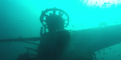
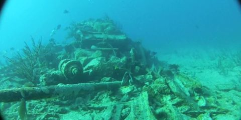
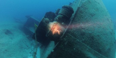
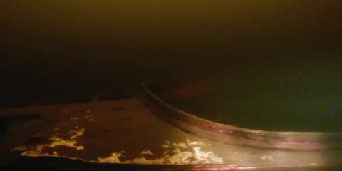
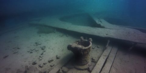
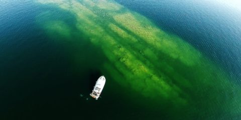
The Hilma Hooker is a 240' long steel ship that had been caught smuggling 25,000 pounds of marijuana in 1984 off the West coast of Bonaire.
Shipwreck Dive N 30° 2.114' W 87° 0.065'
N 30° 2.114′ W 87° 0.065′ “The Mighty O” is a 911′ long by 129′ wide aircraft carrier that was sunk for an artificial reef about 22 miles offshore from Pensacola, Florida. It rests on the sand at 200′ deep. The flight deck is at 150′ and the top of the tower is at 85′. The visibility is about 90′.
N 45° 28.555' W 93° 30.051'
N 45° 28.555′ W 93° 30.051′ This small boat is sitting in 12′ deep water right off the point. The visibility here seems better here than the rest of the lake and the visibility was about 6′.
N 45° 28.270' W 93° 29.938'
N 45° 28.270′ W 93° 29.938′ This is another small wood boat about 120′ from another boat. This one is at 23′ deep and the visibility here is about 3′.
N 45° 28.254' W 93° 29.923'
N 45° 28.254′ W 93° 29.923′ This is a small wood boat in 20′ deep really murky water. The visibility here is about 3′.
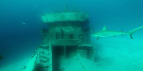
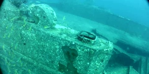
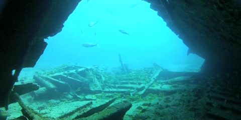
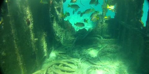
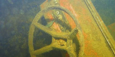
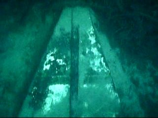
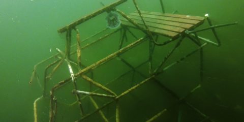
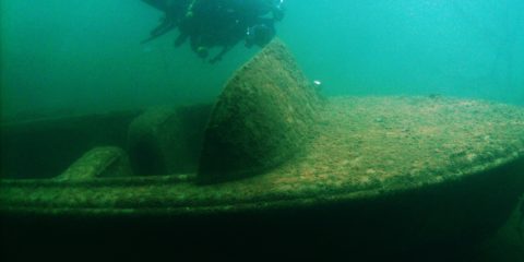
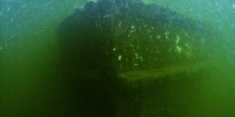
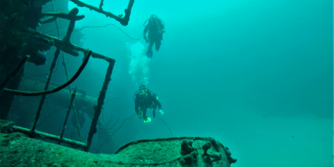
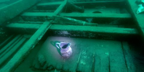
Shipwreck Dive N 24° 58.826' W 77° 32.092'
N 24° 58.826′ W 77° 32.092′ The Ray of Hope is a 200′ ship sitting at 50′ deep on the edge of a wall called the Tongue of the Ocean that drops down to 6,000′ The Ray of Hope sits 40′ away from a small wreck called Bahama Mama. Because the North shark Arena is about 350′ to the South, There are plenty of friendly Caribbean Reef sharks around these two wrecks. Visibility here is about 150′.
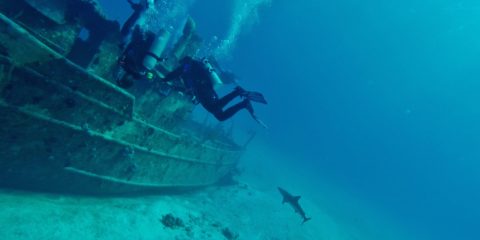
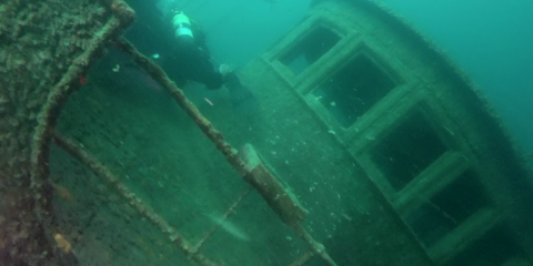
Shipwreck Dive N 24° 58.357' W 77° 31.969'
N 24° 58.357′ W 77° 31.969′ The Sea Viking is a 60′ boat sitting at 75′ deep. it is sitting next to what is called Mikes Reef. Mikes Reef is a nursery for juvenile reef sharks that are practicing to be tough-guys.
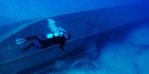
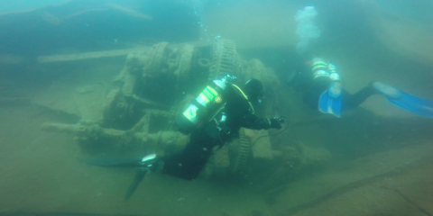
Shipwreck Dive N 25° 5.774' W 77° 19.816'
N 25° 5.774′ W 77° 19.816’The Mail Boat wrecks are also called The Shipyard. They are a 90′ long oil tanker called the Bahama Shell, a 95-foot passenger ship named the Helena C., and a 150-foot supply vessel called the Ana Lise. These 3 are located right next to eachother in 90′ deep water. The visibility is about 100′.
Shipwreck Dive N 25° 6.104' W 77° 18.579'
N 25° 6.104′ W 77° 18.579′ The Car Hauler wreck is sitting upright at 85′ deep. The visibility here is about 60′.
Shipwreck Dive N 25° 5.998' W 77° 18.431'
N 25° 5.998′ W 77° 18.431′ The Miranda is a 90′ wreck that is split in two and sitting in 55′ deep water North of Paradise Island. Visibility here is about 100′.
Shipwreck Dive N 25° 5.859' W 77° 18.645'
N 25° 5.859′ W 77° 18.645′ The Mahoney was a 212′ long steel hulled steamer that sank in 1929 off New Providence Island (North of Paridise Island actually). It was blown apart with dynamite to make it less of an obstruction. It sits at 30′ deep with 50′ of visibility.
Shipwreck Dive N 25° 4.185' W 77° 15.318'
N 25° 4.185′ W 77° 15.318′ This landing Craft sank North East of Rose Island after WW2 when it took on water delivering materials. After that it was used in a James Bond movie Thunderball. It sits in 20′ of water with about 50′ visibility.
Shipwreck Dive N 25° 5.245' W 77° 21.123'
N 25° 5.245′ W 77° 21.123′ The lighthouse wreck is a steel ship that sank just NW from the Nassau Harbor lighthouse. Visibility here is about 50′
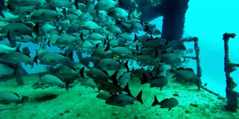
Shipwreck Dive N 21° 7.104' W 86° 43.515'
N 21° 7.104′ W 86° 43.515′ The USS Harlequin was a US Navy Minesweeper in WW2 and it is also known as the C-58 or General AnayaIt was sold to the Mexican Navy and eventually it was deliberately sunk in the 1980s to create an artificial reef. It is sitting at 82′ deep and the visibility here is over 100′.
Shipwreck Dive N 20° 49.525' w 86° 47.397'
N 20° 49.525′ w 86° 47.397′ The US Navy minesweeper named the USS Knave was built in 1943 and sold to the Mexican Navy in 1966 It was sunken as an artificial reef in 1996. The depth is 100′ and the visibility is over 60′.
N 45° 3.491' W 92° 57.797'
N 45° 3.491′ W 92° 57.797′ There isn’t much left of the small steel framed boat that sits in 18′ deep water. This boat was part of a 100 boat fleet of rentals for the Wildwood Amusement Park around 1900. The visibility here is around 10′
N 45° 4.670' W 92° 58.356'
N 45° 4.670′ W 92° 58.356′
N 45° 15.990' W 92° 55.696'
N 45° 15.990′ W 92° 55.696′ This 18′ fiberglass boat is sitting in 16′ deep water on the side of a submerged Island in the third lake of Forest Lake. The visibility here is 3′ in the summer and 5′ in the winter.
N 45° 34.149' W 93° 26.356'
N 45° 34.149′ W 93° 26.356′ The fiberglass I-O runabout is sitting on the side of a submerged island with the lower unit sitting about 10 away from it. I found a wallet with ID’s and some money near the boat and after I turned it in to the sheriffs department, I found out that this boat sank on accident and the 5 people in it did make it to shore.
N 45° 34.230' W 93° 24.257'
N 45° 34.230′ W 93° 24.257′ This small wood sailboat is only about 12′ long. It is sitting in about 20′ deep water about 20′ off the end of a dock on the South end of Spectacle lake. Visibility here is about 15′ in the summer and 30′ in the winter.
N 45° 34.246' W 93° 24.697'
N 45° 34.246′ W 93° 24.697′ This underwater theme park is on the West side of Spectacle Lake. There are a couple boats and a lifeguard tower that we found in the lake and moved them to this central location in 15′ to 25′ deep water. The visibility here is 15′ in the summer and up to 30′ in the winter.
N 45° 34.573' W 93° 26.063'
N 45° 34.573′ W 93° 26.063′ This boat is at about 30′ deep off the big hill on the point. The visibility in green lake is terrible in the summer and only OK in the winter at 10′ to 15′ max.
N 46° 6.550' W 93° 0.349'
N 46° 6.550′ W 93° 0.349′ This old wood boat is sitting at about 35′ deep in the silt at the South end of Grindstone Lake. It is very dark at 35′ deep because of the stained water and the thick silt around this boat can mess it up pretty quickly.
N 46° 28.806' W 94° 0.251'
N 46° 28.806′ W 94° 0.251′ Gilligans Plunge is a dive site where someone placed a fiberglass boat at 30′ deep on the North side of Huntington Mine pit. Just over the ledge from here, at about 110′ deep, there is a Ford Ranger with a topper, but I have not dove that one yet.
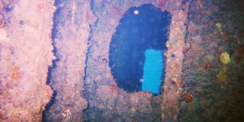
Shipwreck Dive N 49° 3.375' W 113° 54.549'
N 49° 3.375′ W 113° 54.549′ The Gertrude is a 70′ long wood sternwheeler that sank in Upper Waterton Lake just North of Glacier National Park. The stern is at 20′ and the bow is at 60′ The visibility varies but it was about 20′ when I dove it, This lake is at 4,200′ above sea level so you need to be careful to not drive to a higher elevation within 24 hours after diving here.
N 46° 51.829' W 92° 17.928'
N 46° 51.829′ W 92° 17.928′ A small wood boat probably from the 40’s or 50’s on the south shore of Pike Lake near Hermantown, MN. It is sitting in about 6″ of silt at about 25′ deep. The visibility was only about 10′ max.
Shipwreck Dive N 47° 0.700' W 91° 40.677'
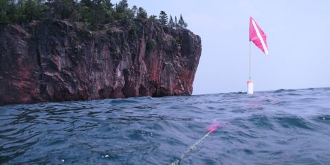
N 47° 0.700′ W 91° 40.677′ The Ely is a 200′ wood three masted schooner-barge that sank in 1896 in Two Harbors, MN. The tugboat Edna G that is still moored in Two Harbors rescued the 10 crew members from the Ely. The wreck is in 30′ of water and about 30′ of the stern is buried under the breakwall. Visibility here ranges from 2′ to 10′ because of the traffic in the harbor.
N 47° 12.354′ W 91° 21.458′ The Madeira is a 436′ steel 3 masted schooner-barge that sank in 1905 off Gold Rock Point just north of Split Rock Lighthouse. The bow is between 40 and 50′ deep. The stern is at 65′, & the pilot house was at 75′ but now what’s left of it is at 100′. There is a large debris field just north of the Stern section.
N 47° 16.295′ W 91° 16.232′ The Hesper was a 250′ wooden-hulled, single-screw, triple-masted, cargo ship that sank in Silver Bay, MN in 1905. The ships hull is split open and the sides are laying in a “V” shape. The bow is in 30′ of water and the rudder is at 48′. Visibility here is seldom over 30 because of the proximity of the harbor traffic.
Shipwreck Dive N 48° 5.118' W 88° 46.000'
N 48° 5.118′ W 88° 46.000′ The Kamloops is a 250′ steel canaler that sank in 1927 near Isle Royale. It’s resting on the bottom at 270′ deep, but the top of the stern is at 180′ deep The top of the bow is at 240′ deep. This is a deep wreck well beyond recreational limits, and it is a wreck to be respected.
Shipwreck Dive N 47° 51.450' W 89° 19.796'
N 47° 51.450′ W 89° 19.796′ The Henry Chisholm was a wooden bulk freighter that sank in 1898 near Rock of Ages Lighthouse at Isle Royale. The 30′ tall engine sits in 115′ deep water and the 12′ diameter prop is at 155′ deep. The visibility here is between 30′ to 40′ and the water is usually around 40 degrees.
Shipwreck Dive N 47° 51.462' W 89° 19.385'
N 47° 51.462′ W 89° 19.385′ The George M. Cox shipwreck (also called ‘Cox on the Rocks’) is a 233′ steel passenger ship that sank in 1933 near Isle Royale. The bow is in 10′ of water and the stern is 100′ deep. The visibility here is about 40′ mostly and the water temps are generally in the 40’s.
Shipwreck Dive N 48° 11.334' W 88° 25.957'
N 48° 11.334′ W 88° 25.957′ The Monarch Shipwreck is a 259′ wood packet ship that sank in 1906 near Isle Royale. It is broken up between 10′ deep to 80′ deep. There is nothing left to penetrate on this wood wreck as the hull is layed open and artifacts are scattered across the site. Visibility is 25′ to 40′ and the water temp is around 45 degrees.
Shipwreck Dive N 48° 11.559' W 88° 30.815'
N 48° 11.559′ W 88° 30.815′ The Chester A. Congdon Bow Shipwreck is the bow section of a 526′ long 56′ wide bulk freighter that sank in 1918 near Isle Royale. The site is from 60′ to 120′ deep and has 4 levels to explore. The bow sits at a 45 degree angle and some call it ‘the fun house’ because of this. Visibility here is usually 30′ with bottom temps about 40 degrees.
Shipwreck Dive N 48° 12.003' W 88° 29.525'
N 48° 12.003′ W 88° 29.525′ The Emperor was 525 feet long, 56 feet in beam. It was hauling 10,000 tons of iron ore when it sank in 1947 just North of Isle Royale. 12 sailors died in this wreck. The sand at the Bow is at 60′. The ‘swim through’ at the turning point for this bow dive is at 93′ deep. At this ‘swim through’ you cross under the 56′ wide hull of the ship. The water is usually about 45 degrees. The visibility is about 40′.
Shipwreck Dive N 48° 12.018' W 88° 29.606'
N 48° 12.018′ W 88° 29.606′ The Emperor was 525 feet long, 56 feet in beam. It was hauling 10,000 tons of iron ore when it sank in 1947 just North of Isle Royale. 12 sailors died in this wreck. The sand at the stern is at 180′. The Engine room is at 150′, and the fantail is at 135′ deep. This is one of the best wrecks in the Great Lakes in my opinion. The water is usually about 45 degrees. The visibility is about 40′.
Shipwreck Dive N 47° 53.631' W 89° 13.341'
N 47° 53.631′ W 89° 13.341′ The America wreck is 180′ long and sank in 1928. The bow is 2′ below the surface and the stern is 80′ below the surface. This is a shallow wreck in fairly cold water. Average water temperatures here in the summer are between 40 and 50 degrees. Visibility varies, but 30′ to 50′ is common.
Amberjack, Artificial Reef, Bait, Mangrove Snapper, Wreck
Artificial Reef, Jewfish, Wreck
Amberjack, Bait, Gag Grouper, Grunts, Jacks, Jewfish, Mangrove Snapper, Scamp Grouper, Snapper, Wreck
Tropical Fish, Wreck
Amberjack, Chris Hudgens, Gag Grouper, Grunts, Hogfish, Jacks, Jewfish, Mangrove Snapper, Reef Fish, Scamp Grouper, Spadefish, Wreck
Chris Hudgens, Gag Grouper, Mangrove Snapper, Red Grouper, Wreck
Amberjack, American Red Snapper, Wreck
Amberjack, American Red Snapper, B Lang, Gag Grouper, Wreck
Hogfish, Mangrove Snapper, Wreck
American Red Snapper, Bait, Gag Grouper, John K, Wreck
American Red Snapper, Bait, Cobia, Gag Grouper, Hogfish, lionfish, Mangrove Snapper, Shark, Wreck
Bait, Barracuda, Grunts, Hogfish, Jacks, lionfish, Mangrove Snapper, Reef Fish, Snapper, Tropical Fish, Wreck
Grunts, Jacks, lionfish, Mangrove Snapper, Reef Fish, Tropical Fish, Wreck
Amberjack, Dark Island Fishing Team, Gag Grouper, Grunts, Jacks, Jewfish, Mangrove Snapper, Wreck
Amberjack, American Red Snapper, Cobia, Dark Island Fishing Team, Gag Grouper, Jacks, Jewfish, lionfish, Mangrove Snapper, Wreck
Amberjack, American Red Snapper, Barracuda, Dark Island Fishing Team, Gag Grouper, Jacks, Jewfish, lionfish, Mangrove Snapper, Wreck
Amberjack, Chris Hudgens, Jewfish, lionfish, Wreck
Amberjack, Cobia, Gag Grouper, Jacks, Mangrove Snapper, Wreck
Amberjack, Jacks, Jewfish, lionfish, Wreck
Amberjack, Gag Grouper, Wreck
American Red Snapper, Gag Grouper, Wreck
Artificial Reef, Paul Varian, Wreck
Artificial Reef, Wreck
Wreck
Artificial Reef, Wreck
Barracuda, Black Grouper, Mangrove Snapper, Reef Fish, Tropical Fish, Wreck
Black Grouper, Jewfish, Mangrove Snapper, Reef Fish, Wreck
Black Grouper, Cubera Snapper, Mutton Snapper, Wreck
Barracuda, Black Grouper, Tropical Fish, Wreck
Amberjack, Artificial Reef, Black Grouper, Hogfish, Jacks, Jewfish, Mangrove Snapper, Mutton Snapper, Wreck
Black Grouper, Grunts, Reef Fish, Wreck
Amberjack, Cobia, Gag Grouper, Jewfish, Mangrove Snapper, Wreck
Amberjack, Gag Grouper, Middle Grounds, Wreck
Artificial Reef, Bonaire, Coral Reef, Reef Fish, Saltwater, Tropical Fish, Wreck
Amberjack, Gag Grouper, Scamp Grouper, Wreck
Coral Reef, Reef Fish, Saltwater, Snapper, Tropical Fish, Wreck, Yellowfin Grouper
Artificial Reef, Gulf of Mexico, Saltwater, Wreck
Freshwater, Wreck
Freshwater, Wreck
Freshwater, Wreck
Bahamas, Saltwater, Wreck
Artificial Reef, Gulf of Mexico, Saltwater, Wreck
Gulf of Mexico, Wreck
Freshwater, Wreck
Freshwater, Wreck
Freshwater, Wreck
Freshwater, Wreck
Freshwater, Wreck
Freshwater, Wreck
Freshwater, Wreck
Freshwater, Wreck
Freshwater, Mine Pit, Wreck
Freshwater, Wreck
Freshwater, Wreck
Freshwater, Lake Superior, Wreck