Navigation Menu
X

Welcome!

There are three ways to Look Underwater:

Using the map, click on any for more information about the location.

Or expand List View by clicking on the "Toggle List View" pop-out tag on the right-hand side.
Map markers may also be filtered using the menus below.

Happy Exploring!

OK, Got it!

Voici Bernadette Wreck

N27 23.870 W80 02.970
December 27, 2020

More Information»

Ft Zack – Shore Dive –

N 24 32.655 W81 48.671
February 21, 2008

More Information»

Lob Flounder –

N27 51.000 W80 09.000
January 19, 2011

More Information»

Lobs Greys Trigs –

N27 51.000 W80 09.000
January 19, 2011

More Information»

AJ Barge –

N27 30.406 W82 59.122
January 5, 2009

More Information»

Permit Barge –

N27 42.602 W82 58.264
June 15, 2004

More Information»

FSFA Artificial Reef Site #2 –

N28 30 210 W80 13 220
February 9, 2009

More Information»

GOM – Pipeline – Reel Animals TV –

N27 52.832 W83 51.777
June 30, 2008

More Information»

Shark Chute – Belize –

N 17 27.959 W88 02.139(?)
February 12, 2019

More Information»

The Big One – Belize –

N 17 27.518 W 88 02.081
February 12, 2019

More Information»

Paso Del Cedral – Cozumel –

N 20 22.095 W 87 1.782
February 19, 2019

More Information»

Yucav – Cozumel –

N 20 25.326 W 87 1.020
February 14, 2019

More Information»

Bayronto Wreck –

N26 45.800 W82 50.839
April 20, 2008

More Information»

Mr Bud – Roatan Honduras –

N 16 20.959 W 86 26.797
February 13, 2019

More Information»

Mary’s Place – Roatan Honduras –

N 16 20.259 W 86 28.137
February 12, 2019

More Information»

Black Triggerfish Reef –

Unknown
August 18, 2012

More Information»

Three Sisters –

N28 00.000 W28 00.000
August 12, 2005

More Information»

Isla Tortuga – Costa Rica –

N 09 46.161 W84 53.531
September 15, 2005

More Information»

Cayo Sal – Caraballeda Venezuela –

N10 37.459 W66 51.430
March 18, 2005

More Information»

Tropic Star Boat Dock –

N07 35.036 W78 12.033
December 18, 2012

More Information»

Mountain Point – Ketchikan Alaska

N55 17.6101 W131 32.856
July 13, 2007

More Information»

Abandoned Boat – Panama –

N07 28.205 W78 16.101
December 18, 2012

More Information»

Concrete Pilings –

N28 23.000 W83 23.000
January 30, 2006

More Information»

Grand Canyon – El Tovar

36 3.449'N 112 8.242'W
January 5, 2020

More Information»

Sinkhole Wreck –

N28 23.000 W83 18.000
January 30, 2006

More Information»

Reel Animals Grouper Rocks –

N27 38.103 W82 37.617
October 23, 2007

More Information»

Fish Traps Big Pine –

N24 33.559 W81 19.404
January 11, 1990

More Information»

B S Wreck –

N28 14.000 W83 31.000
October 2, 2004

More Information»

Lobster Fuel Tank –

N24 44.000 W81 31.000
March 9, 2003

More Information»

Lobster Car Hood –

N24 44.000 W81 31.000
March 9, 2003

More Information»

American Shoal –

N24 31.417 W81 31.125
March 11, 2003

More Information»

Yoza –

N28 41.000 W83 20.000
September 24, 2003

More Information»

Blue Marlin Surprise –

N27 14.000 W83 17.000
May 25, 2004

More Information»

Yep –

N28 29.346 W84 15.945
October 10, 2003

More Information»

Donny Barge South –

N27 34.000 W80 02.000
December 10, 2004

More Information»

Donny Barge North –

N27 34.000 W80 02.000
December 10, 2004

More Information»

Big Pine Shallow Bait –

N24 37.000 W81 23.000
October 22, 2010

More Information»

Egmont Barge (Name?) –

N 27 32.285 W 82 52.198
April 29, 2009

More Information»

Greek –

N28 30.000 W84 18.000
March 16, 2003

More Information»

Coalbin Rock Area –

N24 27.059 W82 05.296
August 21, 2012

More Information»

Delila – Cozumel –

N20 22.185 W87 01.766
November 12, 2010

More Information»

Egmont Mango –

N27 35.000 W82 54.000
February 21, 2003

More Information»

SM1 – Air Force Tower –

N29 04.756 W84 19.199
December 13, 2003

More Information»

JLB Pelican Shoal –

N24 30.111 W81 37.921
February 14, 2006

More Information»

Capt Ben Flounder Sinkhole –

N29 27.000 W83 59.000
December 27, 2008

More Information»

Tormentos – Cozumel –

N 20 26.039 W 87 0.613
November 12, 2010

More Information»

9 Mile Reef Sandbar –

N29 41.402 W83 35.221
September 2, 2018

More Information»

Columbia Deep – Cozumel –

N20 18.191 W87 01.442
May 22, 2005

More Information»

John K Drone –

N29 17.000 W83 52.000
September 8, 2010

More Information»

Troy Thompson Scallop –

N29 44.000 W83 37.000
September 1, 2018

More Information»

Capt Ben Good Scallop –

N29 44.000 W83 37.000
September 2, 2018

More Information»

Lake Baikal –

52.8533851031521 107.4875096874999
June 26, 2020

More Information»

Six Pack Ledge –

N28 58.000 W84 00.000
April 18, 2018

More Information»

Incredible Sinkhole –

N29 08.000 W84 07.000
February 16, 2018

More Information»

Capt Ben Ledge –

N29 39.000 W83 43.000
February 15, 2018

More Information»

Steinhatchee Artificial Reef Culverts –

N29 39.951 W83 37.704
February 15, 2018

More Information»

JK 152 RS –

N29 09.000 W83 52.000
December 15, 2015

More Information»

80 Wreck –

N29 33.000 W83 57.000
May 12, 2015

More Information»

Sapona Wreck –

N25 39.042 W79 17.600
April 18, 2011

More Information»

Bimini Barge Wreck –

N25 41.875 W79 19.019
August 18, 2012

More Information»

College Rock –

N29 16.000 W84 00.000
May 18, 2014

More Information»

Chichen – Itza

20 40.757 N 88 34.134 W
March 31, 2019

More Information»

Alachua Sink –

29 48.407 N 82 30.629 W
April 28, 2018

More Information»

Panacea Barge Wreck –

N29 12.000 W83 54.000
May 18, 2014

More Information»

MV Adolphus Busch Wreck –

N24 31.810 W81 27.678
May 16, 2003

More Information»

Hog Reef –

N33 13.000 W78 01.000
August 10, 2018

More Information»

Scamps Hog Up High –

N33 17.000 W77 50.000
August 10, 2018

More Information»

Scattered Bait Rock –

N33 17.000 W77 50.000
August 10, 2018

More Information»

East Chicken Coups –

N29 14.000 W83 50.000
June 20, 2009

More Information»

West Chicken Coups –

N29 10.000 W83 50.000
May 6, 2014

More Information»

RS Horseshoe –

N33 17.000 W77 50.000
August 10, 2018

More Information»

Rick Ruth –

N27 39.000 W80 07.000
July 25, 2018

More Information»

Vis Check Mini –

N27 38.000 W80 08.000
July 25, 2018

More Information»

High Side Left Ledge –

N27 39.000 W80 08.000
July 25, 2018

More Information»

087 Snap Lob –

N27 39.000 W80 08.000
July 25, 2018

More Information»

0535 Ninja Ruth –

N27 38.000 W80 08.000
July 25, 2018

More Information»

509 Rock –

N27 51.000 W80 09.000
January 19, 2011

More Information»

Porta Allegra (Lobster Wreck)-

N33 51.280 W76 57.860
June 1, 2009

More Information»

Mushroom Rock –

N28 28.000 W84 18.000
June 7, 2007

More Information»

Playground –

N28 26.000 W84 16.000
May 25, 2008

More Information»

Twins –

N28 34.000 W84 20.000
May 24, 2008

More Information»

JP 005 –

N27 51.000 W82 57.000
May 27, 2009

More Information»

JP 009 –

N27 49.000 W83 04.000
May 30, 2005

More Information»

1669 Mango –

N27 47.000 W82 56.000
May 27, 2009

More Information»

Sal Big Black Grouper –

N26 51.000 W83 31.000
May 27, 2011

More Information»

Big Big Cave –

N29 14.000 W83 50.000
June 20, 2009

More Information»

Flat Rock –

N29 14.000 W83 54.000
June 20, 2009

More Information»

Bruce 2 Gags –

N29 38.000 W83 49.000
February 15, 2018

More Information»

90FT Shrimp Boat Wreck –

N29 00.000 W84 00.000
May 21, 2012

More Information»

Mitchel Wreck (Tug Boat) –

N29 12.000 W83 52.000
May 15, 2010

More Information»

Axel –

N28 17.000 W83 55.000
June 10, 2014

More Information»

Pipe Hog –

N27 43.000 W83 27.000
January 5, 2009

More Information»

Collector (Artificial Reef)-

N26 49.029 W83 09.599
June 3, 2010

More Information»

Galactica –

N27 11.000 W83 10.000
August 22, 2015

More Information»

Looe Key Reef –

N24 32.687 W81 24.551
March 9, 2003

More Information»

Molasses Reef –

N25 00.474 W80 22.600
May 10, 2012

More Information»

JP 007 –

N27 50.000 W83 02.000
May 30, 2005

More Information»

Rhino Ledge –

N29 14.000 W84 09.000
November 5, 2017

More Information»

The Gwalia – Middle Grounds Tugboat Wreck –

N28 29.891 W84 06.885
October 1, 2005

More Information»

Three Sisters –

N28 27.000 W84 18.000
August 12, 2005

More Information»

Fezon Sinkhole –

N29 20.000 W83 54.000
June 29, 2020

More Information»

U-2513 (WWII German U-Boat) –

24 52.015 N 83 18.594 W
June 16, 2014

More Information»

Walkers Reef –

W27 17.524 N78 25 897
June 18, 2018

More Information»

B-Lang Hog to Jack Head –

N27 11.000 W78 12.000
June 18, 2018

More Information»

Big Black –

N27 17.000 W78 27.000
June 18, 2018

More Information»

Coral Heads 2 -1

W 27 15.001 N 78 25.415
June 18, 2018

More Information»

5000 Snapper –

N28 25.000 W84 17.000
June 7, 2006

More Information»

Holey Rock –

N28 19.000 W84 26.000
May 18, 2005

More Information»

MV Holstein – (aka Flour Wreck)-

N28 19.170 W84 26.361
May 10, 2004

More Information»

Lady Ora –

N28 30.000 W84 20.000
May 24, 2008

More Information»

Jerry Chez –

N28 22.000 W84 11.000
June 27, 2008

More Information»

Jack Boat Ledge –

N28 29.000 W84 20.000
April 21, 2006

More Information»

Harvey Killer Chez –

N28 41.000 W84 23.000
April 16, 2006

More Information»

Tiger 8+ –

N27 14.000 W78 16.000
June 18, 2018

More Information»

Lobster Reef –

N27 20.000 W78 39.000
June 15, 2018

More Information»

Small Hog Reef –

N27 14.000 W78 16.000
June 18, 2018

More Information»

0088 CH –

N27 14.000 W78 16.000
June 18, 2018

More Information»

BHogg to 4489 –

N27 14.153 W78 16.239
June 18, 2018

More Information»

GR Ledge –

N 27 22.000 W 78 42.000
June 15, 2018

More Information»

Good Roc1 –

N27 19.873 W78 34.410
June 15, 2018

More Information»

Holey Carbo –

N28 18.000 W84 08.000
June 27, 2008

More Information»

Gully Break –

N28 27.000 W84 16.000
June 28, 2008

More Information»

Gully –

N28 34.000 W84 20.000
February 9, 2007

More Information»

GS2 – Scar Faced Hog –

N28 29.000 W84 20.000
June 2, 2006

More Information»

Go Factory –

N28 26.000 W84 14.000
June 28, 2008

More Information»

Goat Cracks –

N28 29.000 W84 17.000
June 2, 2006

More Information»

Firemouth –

N28 27.000 W84 18.000
June 7, 2006

More Information»

Dusk Hog –

N28 18.000 W84 07.000
June 27, 2008

More Information»

Deco Time –

N28 20.000 W84 12.000
June 27, 2008

More Information»

Dancing Hog –

N28 16.000 W84 06.000
August 4, 2006

More Information»

Boulder Canyon –

N28 26.000 W84 18.000
April 21, 2006

More Information»

Big On Top –

N28 26.000 W84 16.000
June 28, 2008

More Information»

Big Dirty –

N28 28.000 W84 17.000
June 28, 2008

More Information»

Head Start Wreck (Shrimp Boat) –

N28 51.000 W84 25.000
May 16, 2009

More Information»

Cozumel –

N28 26.000 W84 15.000
June 28, 2008

More Information»

Flower Garden –

N28 41.000 W84 23.000
July 19, 2012

More Information»

Mikes Pair –

N28 17.000 W84 05.000
June 27, 2008

More Information»

Tenneco Towers Wreck (Oil Platforms) –

N25 58.890 W80 04.798
October 5, 2009

More Information»

Dantor Wreck –

N26 00.598 W80 04.989
October 5, 2009

More Information»

Trio Bravo Wreck –

N26 08.727 W80 04.293
October 5, 2009

More Information»

Tracor Wreck (Dry Dock) –

N26 06.764 W80 04.233
October 5, 2009

More Information»

Ande Wreck –

N26 47.280 W79 59.539
October 5, 2009

More Information»

Skycliff Wreck –

N26 33.402 W80 01.081
October 5, 2009

More Information»

Rodeo 25 Wreck (Nore) –

N26 13.860 W80 03.833
October 4, 2009

More Information»

Dewitt Clinton Wreck –

N26 14.065 W80 03.666
October 4, 2009

More Information»

Johnny Morris Wreck –

N26 14.383 W80 03.411
October 4, 2009

More Information»

Hydro Atlantic Wreck

N26 19.500 W80 03.043
October 4, 2009

More Information»

Cruz Del Sur Wreck –

N25 58.167 W80 04.637
October 4, 2009

More Information»

M/V Castor Wreck –

N26 28.739 W80 02.234
October 4, 2009

More Information»

Ft Jefferson –

N24 37.717 W82 52.390
March 24, 2011

More Information»

Eagle Wreck –

N24 52.180 W80 34.210
June 12, 2010

More Information»

USCGC Duane Wreck –

N24 59.380 W080 22.920
June 13, 2010

More Information»

USS Curb Wreck –

N24 27.227 W81 46.276
May 24, 2009

More Information»

Cayman Salvager Wreck –

N24 27.655 W81 46.025
August 1, 2003

More Information»

Thunderbolt Wreck –

N24 39.761 W80 57.111
March 8, 2003

More Information»

Tom G Snapper Ledge –

N27 14.000 W83 07.000
March 16, 2002

More Information»

USS Spiegel Grove –

N25 04.003 W80 18.656
November 7, 2005

More Information»

Captain Gil Tug –

N28 41.000 W83 38.000
November 16, 2003

More Information»

South Jack Hole –

N27 17.000 W83 09.000
October 13, 2002

More Information»

Devils Ledge –

N28 57.000 W84 08.000
December 20, 2003

More Information»

Lamb Spring –

N 29 26.679 W 83 50.515
April 28, 2008

More Information»

Carrabelle Cave –

N29 19.000 W83 52.000
December 19, 2003

More Information»

Ultimate Dive – Ulti –

N28 32.000 W84 19.000
May 24, 2008

More Information»

No Shark – FMG –

N28 37.000 W84 16.000
November 30, 2007

More Information»

Ruthie Hog – FMG –

N28 40.000 W84 23.000
June 15, 2007

More Information»

Super Grouper – FMG –

N28 34.000 W84 20.000
February 9, 2007

More Information»

Sand Tiger Canyon – FMG –

N28 25.000 W84 18.000
June 13, 2009

More Information»

Tommy ARS – FMG –

N28 26.000 W84 11.000
June 30, 2008

More Information»

Show Jerry – FMG –

N28 28.000 W84 18.000
June 7, 2006

More Information»

Nate Bait – FMG –

N28 30.000 W84 19.000
April 16, 2006

More Information»

Magic Mushroom – FMG –

N28 11.000 W84 03.000
January 2, 2004

More Information»

Pipes – FMG –

N28 34.205 W84 23.587
June 25, 2004

More Information»

3 Sisters – FMG

N28 27.000 W84 18.000
August 12, 2005

More Information»

Red Neck Ledge – FMG

N28 30.000 W84 19.000
June 24, 2004

More Information»

Mini Greek – FMG –

N28 27.000 W84 18.000
April 21, 2006

More Information»

Tape Cheez – FMG –

N28 29.000 W84 21.000
April 21, 2006

More Information»

Gully Cheez – FMG –

N28 34.000 W84 20.000
February 9, 2006

More Information»

Mangs –

N28 38.000 W84 16.000
December 2, 2005

More Information»

Jacko Bug –

N28 28.000 W84 14.000
December 2, 2005

More Information»
Something Special

Something Special

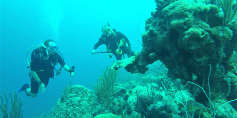
The dive site "Something Special" in Bonaire is on the north end of town and the entry is easy.
March 22020

Something Special

N12 10.310 W68 17.374
February 6, 2020

More Information»
Shawns Wall

Shawns Wall

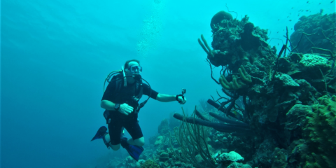
We named this dive site Shawns wall because it was his first dive below the 100' threshold.
February 272020

Shawns Wall

N 12 11.051 W 68 17.774
February 6, 2020

More Information»
1,000 Steps Bonaire

1,000 Steps Bonaire

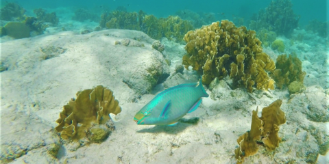
Although this dive site is called 1,000 steps, the stone stairway leading down the cliff to the water only has 67 steps.
February 272020

1,000 Steps Bonaire

N 12 12.603 W 68 19.323
February 5, 2020

More Information»
Salt Pier Bonaire

Salt Pier Bonaire

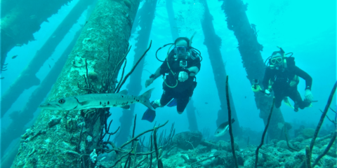
The salt pier dive site in Bonaire is a "must dive" if you are in Bonaire.
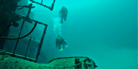
February 272020

Salt Pier Bonaire

N 12 4.969 W 68 17.017
February 4, 2020

More Information»
Hilma Hooker Bonaire

Hilma Hooker Bonaire

The Hilma Hooker is a 240' long steel ship that had been caught smuggling 25,000 pounds of marijuana in 1984 off the West coast of Bonaire.
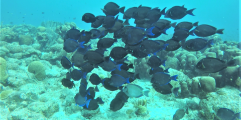
February 272020

Hilma Hooker Bonaire

N 12 6.212 W 68 17.370
February 4, 2020

More Information»
Angel City

Angel City

Angel City is a double reef that is separated by a small lake of sand.

February 272020

Angel City

N 12 6.156 W 68 17.316
February 3, 2020

More Information»
Punt Vierkant Bonaire

Punt Vierkant Bonaire

Punt Vierkant is the name of a divesite on the West coast of Bonaire.

February 272020

Punt Vierkant Bonaire

N 12 6.484 W 68 17.565
February 1, 2020

More Information»

Isla Holbox – Whale Sharks Manta Rays –

N 21 32.848 W87 23.152
July 30, 2018

More Information»

Hot Pothole –

N33 41.000 W77 00.000
July 15, 2019

More Information»

Red Snapper Sink –

N29 44.260 W80 44.520
May 26, 2019

More Information»

Jumpy Scamps –

N33 41.000 W77 01.000
July 15, 2019

More Information»

Red Grouper Horseshoe –

N33 42.000 W77 01.000
July 15, 2019

More Information»

1 Red Grouper Hole –

N33 42.000 W77 03.000
July 15, 2019

More Information»

26 lb Scamp Ledge –

N33 43.000 W77 08.000
July 15, 2019

More Information»

Bait Lob Break –

N33 43.000 W77 09.000
July 15, 2019

More Information»

Puzzle Piece Break –

N33 41.000 W77 08.000
August 5, 2019

More Information»

Grass Top Ledge –

N33 42.000 W77 09.000
August 5, 2019

More Information»

Garden Ledge –

N33 41.000 W77 10.000
August 5, 2019

More Information»

Hide and Seek –

N33 39.000 W77 11.000
August 4, 2019

More Information»

Deep Grouper Cave –

N 33 39.000 W 77 14.000
August 4, 2019

More Information»

XL Lobs Sneaky Gag Caves –

N 33 16.000 W 77 44.000
August 2, 2019

More Information»

Happy Hog Cleaners –

N 33 16.000 W 77 45.000
August 2, 2019

More Information»

Spade Runner Break –

N 33 15.000 W 77 45.000
August 2, 2019

More Information»

Lobster Crack –

N 33 15.000 W 77 45.000
August 2, 2019

More Information»

Lion Flat Rock –

N 33 15.000 W 77 45.000
August 2, 2019

More Information»

Low Lobster Lion Ledge –

N 33 15.000 W 77 46.000
August 2, 2019

More Information»

Glory Hole (Spring Hole) –

N 28 25.000 W 83 27.000
June 20, 2018

More Information»

Hogfish Herd –

N 33 15.000 W 77 46.000
August 2, 2019

More Information»

Lobster Lion Ledge –

N33 10.000 W78 0.000
August 2, 2019

More Information»

Scamps Lions RS Cave –

N 33 11.000 W 78 1.000
August 2, 2019

More Information»

Low Bottom Scrap –

N 33 14.00 W 77 58.000
August 1, 2019

More Information»

Gag Grouper RS 2 Caves –

N 33 11.000 W 78 0.000
August 2, 2019

More Information»

Low Bottom Empty –

N33 10.000 W 77 59.000
August 1, 2019

More Information»

NC Megalodon Dive 001 –

N 33 33.000 W 77 27.000
August 4, 2019

More Information»

2 Scamp 2 Hog 1 RG –

N 33 14.000 W 77 54.000
August 1, 2019

More Information»

Mary Poppins –

N 33 11.000 W 77 55.000
August 1, 2019

More Information»

Jack Valley with Wahoo Safety Stop – Elbow –

N 27 45.307 W 84 9.956
August 27, 2019

More Information»

North Peak – Elbow –

N 27 43.825 W 84 10.475
August 27, 2019

More Information»

South Peak – Elbow –

N 27 43.120 W 84 10.560
August 27, 2019

More Information»

2 Scamp 1 RS Small Ledge –

N 33 12.000 W 77 53.000
August 1, 2019

More Information»

Scamp Hole with RS –

N 33 15.000 W 77 54.000
August 1, 2019

More Information»

Blue Runner Feeding Frenzy –

N 33 11.000 W 77 59.000
August 1, 2019

More Information»

Dark Island Fishing Team Rock Piles –

N29 18.000 W83 55.000
January 25, 2009

More Information»

Walkers Conch Dive –

N27 15.204 W78 23.473
June 11, 2019

More Information»

Shrimp Boat – 40 NM Port Richey –

N28 06.000 W83 36.000
June 4, 2008

More Information»

535 Hard Bottom – 40 NM off of New Port Richey –

N28 15.383 W83 33.728
June 4, 2008

More Information»

PT Fish – Matanilla Reef –

N 27 22.153 W 78 42.106
June 9, 2019

More Information»

Middle Grounds – Matanilla Reef –

N 27 22.981 W 78 41.911
June 9, 2019

More Information»

Elkhorn – Matanilla Reef –

N 27 22.956 W 78 41 927
June 9, 2019

More Information»

Shell Island Snook –

N 27 39.191 W 82 44.436
April 3, 2006

More Information»

Hogfish Shootout Ledge –

????
August 2, 2019

More Information»

Jupiter Loran Tower –

N27 03.570 W80 03.936
May 4, 2019

More Information»

Upside-down Jellyfish (Cassiopea) –

N 27 11.773 W 78 17.096
June 9, 2019

More Information»

Double Breasted – Grand Cay –

N 27 11.773 W 78 17.096
June 11, 2019

More Information»

Yellowfin Wreck – Matanilla Reef –

N27 22.000 W78 41.000
June 9, 2019

More Information»

Jurrasic RS (2181 WRK) –

N29 12.000 84 18.000
May 17, 2019

More Information»

Petes Ledge (JK0448) –

N27 07.000 W84 04.000
May 16, 2019

More Information»

Petes Shark Ledge (2323 WRK) –

N29 11.000 84 18.000
May 16, 2019

More Information»

RG Hole Sm Fish 94Ft –

N29 11.000 W84 18.000
May 16, 2019

More Information»

Ben Red Gag –

N29 20.000 W83 54.000
April 12, 2019

More Information»

JK06 CHUNKY –

N29 21.000 W83 54.000
April 12, 2019

More Information»

5 Gag Hot –

N29 20.000 W83 54.000
April 12, 2019

More Information»

Unconfirmed Locations Cozumel

Cozumel – 2nd Dive – May 2005

Cozumel 1st Dive – February 25 2006

Cozumel 2nd Dive – February 25 2006

Cozumel – 1st Dive – Oct 31 2009

Cozumel – 2nd Dive – Oct 31 2009

I need help identifying these dive locations. Please leave a comment if you know where exactly these locations are. Thank you for your help!

capt. ben

More Information»

National Fishermans Producers Cooperative

N 17 29.654 W 88 11.094


More Information»

Sea Sports Belize

N 17 29.702 W 88 11.183

More Information»

Unknown Coral Reef

Need to be identified so that accurate coordinates can be added. Reef is near the Sapona Wreck.

August 18 2012

More Information»

Tropic Star Run Back Inshore

N 07 32.235  W 78 12.968

December 18 2012

More Information»
USS Oriskany Aircraft Carrier (CV-34)

USS Oriskany Aircraft Carrier (CV-34)

Shipwreck Dive N 30° 2.114' W 87° 0.065'

August 102018

N 30° 2.114′ W 87° 0.065′ “The Mighty O” is a 911′ long by 129′ wide aircraft carrier that was sunk for an artificial reef about 22 miles offshore from Pensacola, Florida. It rests on the sand at 200′ deep. The flight deck is at 150′ and the top of the tower is at 85′. The visibility is about 90′.

More Information»
Boat Near the Point at Blue Lake near Crown, MN

Boat Near the Point at Blue Lake near Crown, MN

N 45° 28.555' W 93° 30.051'

August 92018

N 45° 28.555′ W 93° 30.051′ This small boat is sitting in 12′ deep water right off the point. The visibility here seems better here than the rest of the lake and the visibility was about 6′.

More Information»
Boat in the Bay at Blue Lake Near Crown, MN

Boat in the Bay at Blue Lake Near Crown, MN

N 45° 28.270' W 93° 29.938'

August 92018

N 45° 28.270′ W 93° 29.938′ This is another small wood boat about 120′ from another boat. This one is at 23′ deep and the visibility here is about 3′.

More Information»
Boat by the Landing in Blue Lake near Crown, MN

Boat by the Landing in Blue Lake near Crown, MN

N 45° 28.254' W 93° 29.923'

August 92018

N 45° 28.254′ W 93° 29.923′ This is a small wood boat in 20′ deep really murky water. The visibility here is about 3′.

More Information»
North Shark Arena at New Providence Island, Bahamas
August 62018

N 24° 58.755′ W 77° 32.094′ Stuart Coves North Shark Arena is about 350′ South of the Ray of Hope and Bahama Mama wrecks. They feed the Nurse Sharks off to the side just prior to feeding about 14 Caribbean reef sharks becaude the nurse sharks are sloppy eaters and the extra chum in the water from this confuses the reef sharks. IT was a lot of fun to be this close to them.
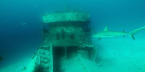
More Information»
Ray of Hope Wreck at New Providence Island, Bahamas

Ray of Hope Wreck at New Providence Island, Bahamas

Shipwreck Dive N 24° 58.826' W 77° 32.092'

August 62018

N 24° 58.826′ W 77° 32.092′ The Ray of Hope is a 200′ ship sitting at 50′ deep on the edge of a wall called the Tongue of the Ocean that drops down to 6,000′ The Ray of Hope sits 40′ away from a small wreck called Bahama Mama. Because the North shark Arena is about 350′ to the South, There are plenty of friendly Caribbean Reef sharks around these two wrecks. Visibility here is about 150′.
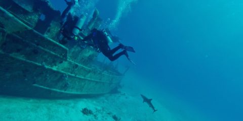
More Information»
Sea Viking Wreck at New Providence Island, Bahamas

Sea Viking Wreck at New Providence Island, Bahamas

Shipwreck Dive N 24° 58.357' W 77° 31.969'

August 42018

N 24° 58.357′ W 77° 31.969′ The Sea Viking is a 60′ boat sitting at 75′ deep. it is sitting next to what is called Mikes Reef. Mikes Reef is a nursery for juvenile reef sharks that are practicing to be tough-guys.

More Information»
Lost Blue Hole at New Providence Island, Bahamas
August 42018

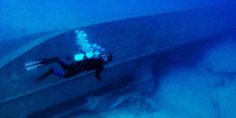
N 25° 1.604′ W 77° 8.530′ The Lost Blue hole is 7 miles East of New Providence Island and 5 miles South of Rose Island. It is 40′ down to the sand at the top of the 85′ wide hole. The bottom of the hole is 200′ deep. He had 6 Black Tip sharks, 1 Bull shark and a couple nurse sharks with us. The visibility is over 100′.
More Information»
Three Mail Boat Wrecks at Paradise Island, Bahamas

Three Mail Boat Wrecks at Paradise Island, Bahamas

Shipwreck Dive N 25° 5.774' W 77° 19.816'

August 42018

N 25° 5.774′ W 77° 19.816’The Mail Boat wrecks are also called The Shipyard. They are a 90′ long oil tanker called the Bahama Shell, a 95-foot passenger ship named the Helena C., and a 150-foot supply vessel called the Ana Lise. These 3 are located right next to eachother in 90′ deep water. The visibility is about 100′.

More Information»
Car Hauler Wreck at Paradise Island, Bahamas

Car Hauler Wreck at Paradise Island, Bahamas

Shipwreck Dive N 25° 6.104' W 77° 18.579'

August 42018

N 25° 6.104′ W 77° 18.579′ The Car Hauler wreck is sitting upright at 85′ deep. The visibility here is about 60′.

More Information»
Miranda Wreck at Paradise Island, Bahamas

Miranda Wreck at Paradise Island, Bahamas

Shipwreck Dive N 25° 5.998' W 77° 18.431'

August 42018

N 25° 5.998′ W 77° 18.431′ The Miranda is a 90′ wreck that is split in two and sitting in 55′ deep water North of Paradise Island. Visibility here is about 100′.

More Information»
Mahoney Wreck at Paradise Island, Bahamas

Mahoney Wreck at Paradise Island, Bahamas

Shipwreck Dive N 25° 5.859' W 77° 18.645'

August 42018

N 25° 5.859′ W 77° 18.645′ The Mahoney was a 212′ long steel hulled steamer that sank in 1929 off New Providence Island (North of Paridise Island actually). It was blown apart with dynamite to make it less of an obstruction. It sits at 30′ deep with 50′ of visibility.

More Information»
Fish Hotel at Salt Cay, Bahamas

Fish Hotel at Salt Cay, Bahamas

N 25° 6.556' W 77° 16.365'

August 32018

N 25° 6.556′ W 77° 16.365′ Fish Hotel is a rocky reef on the North side of Salt Cay. The easterly current is strong here but the ledges hod a lot of fish and a few lobster. The depth is about 40′ and the visibility is about 50′.

More Information»
Periwinkle Reef at Rose Island, Bahamas

Periwinkle Reef at Rose Island, Bahamas

N 25° 4.391' W 77° 11.903'

August 32018

N 25° 4.391′ W 77° 11.903′ Periwinkle reef is a shallow drift dive over a soft coral reef just South of Rose Island. It is about 30′ deep with visibility about 70′

More Information»
Landing Craft Wreck at Atholl Cay, Bahamas

Landing Craft Wreck at Atholl Cay, Bahamas

Shipwreck Dive N 25° 4.185' W 77° 15.318'

August 32018

N 25° 4.185′ W 77° 15.318′ This landing Craft sank North East of Rose Island after WW2 when it took on water delivering materials. After that it was used in a James Bond movie Thunderball. It sits in 20′ of water with about 50′ visibility.

More Information»
Lighthouse Wreck at Nassau, Bahamas

Lighthouse Wreck at Nassau, Bahamas

Shipwreck Dive N 25° 5.245' W 77° 21.123'

August 32018

N 25° 5.245′ W 77° 21.123′ The lighthouse wreck is a steel ship that sank just NW from the Nassau Harbor lighthouse. Visibility here is about 50′

More Information»
The Throne Room at Negril, Jamaica

The Throne Room at Negril, Jamaica

N 18° 16.937' W 78° 21.957'

August 22018

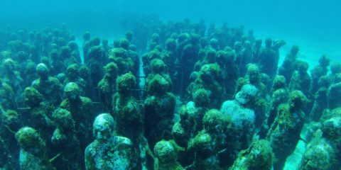
N 18° 16.937′ W 78° 21.957′ The Throne Room is a large and low cave which has its base at 60′ wide and its top at 40′ in depth. There are several small fish hanging around the area and visibility is about 50′
More Information»

N 21° 12.083′ W 86° 43.630′ Jaime Gonzalez Canto and Jason deCaires Taylor created an underwater museum of 500+ concrete statues as an artificial reef for coral to grow on. It is hard to see them all in one dive, but once you’ve seen them, its enough. The visibility here is only about 50′.

More Information»
Banderas Reef off Isla Mujeres, Mexico

Banderas Reef off Isla Mujeres, Mexico

N 21° 11.243' W 86° 43.482'

August 22018

N 21° 11.243′ W 86° 43.482′ Bandera reef is a long coral reef topped with elk horn coral. Because of the strong current here, it is a drift dive. Visibility here is about 80′.

More Information»
Manchones Reef off Isla Mujeres, Mexico

Manchones Reef off Isla Mujeres, Mexico

N 21° 12.148' W 86° 42.998'

August 22018

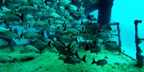
N 21° 12.148′ W 86° 42.998′ The Manchones Reef is a popular dive spot on Mexico’s Mesoamerican Barrier Reef (also known as the Great Mayan Reef), on the Caribbean coast of Quintana Roo. Visibility here is about 80′.
More Information»
USS Harlequin Wreck (C-58) off Cancun, Mexico

USS Harlequin Wreck (C-58) off Cancun, Mexico

Shipwreck Dive N 21° 7.104' W 86° 43.515'

August 22018

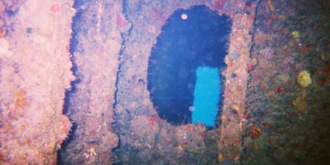
N 21° 7.104′ W 86° 43.515′ The USS Harlequin was a US Navy Minesweeper in WW2 and it is also known as the C-58 or General AnayaIt was sold to the Mexican Navy and eventually it was deliberately sunk in the 1980s to create an artificial reef. It is sitting at 82′ deep and the visibility here is over 100′.
More Information»
USS Knave Wreck (C-56) off Puerto Morelos, Mexico

USS Knave Wreck (C-56) off Puerto Morelos, Mexico

Shipwreck Dive N 20° 49.525' w 86° 47.397'

August 12018

N 20° 49.525′ w 86° 47.397′ The US Navy minesweeper named the USS Knave was built in 1943 and sold to the Mexican Navy in 1966 It was sunken as an artificial reef in 1996. The depth is 100′ and the visibility is over 60′.

More Information»
Dos Ojos Cenote at Tulum, Mexico

Dos Ojos Cenote at Tulum, Mexico

N 20° 19.481' W 87° 23.479'

August 12018

N 20° 19.481′ W 87° 23.479′ Dos Ojos Cenote is actually two cavern dives that turn into full cave at the ends of each. One leg is called the Bat Cave and the other is called the Barbie Line. The barbie line is 415 meters (1361′) long. The bat Cave is 320 meters (1056′) long. Water temps are 77 degrees year round. The visibility is over 100′

More Information»
Trailer Dolly in White Bear Lake, MN

Trailer Dolly in White Bear Lake, MN

N 45° 4.656' W 92° 58.412'

July 202018

N 45° 4.656′ W 92° 58.412′ I don’t know exactly what this is, but I think its a trailer dolly for moving boat trailers around a boat yard. Its sitting in 28′ deep water. The visibility here is about 10′

More Information»
Small Steel Framed Boat in White Bear Lake, MN

Small Steel Framed Boat in White Bear Lake, MN

N 45° 3.491' W 92° 57.797'

July 202018

N 45° 3.491′ W 92° 57.797′ There isn’t much left of the small steel framed boat that sits in 18′ deep water. This boat was part of a 100 boat fleet of rentals for the Wildwood Amusement Park around 1900. The visibility here is around 10′

More Information»
Judges Boat in White Bear Lake, MN

Judges Boat in White Bear Lake, MN

N 45° 4.670' W 92° 58.356'

July 202018

N 45° 4.670′ W 92° 58.356′

More Information»
Aluminum Shorestation Boat Lift in White Bear Lake, MN
July 202018

N 45° 4.581′ W 92° 59.288′ This aluminum boatlift was blown upside down and floated to its current location in 2003 according to the person that used to own it. It now is sitting upside down in 20′ deep water on its canopy. There are a few large bass calling it home. Visibility here is about 10′ in the summer.

More Information»
Shadyland Point in Forest lake, MN

Shadyland Point in Forest lake, MN

N 45° 15.893' W 92° 55.150'

July 202018

N 45° 15.893′ W 92° 55.150′ We have been doing a lot of diving near Shadyland Point to look for a F-51 Mustang plane that crashed near here in 1954. We haven’t found the plane yet, but we have found some other interesting things. The visibility here is 3′ in the summer and 5′ in the winter.

More Information»
1967 Camaro in Forest Lake, MN

1967 Camaro in Forest Lake, MN

N 45° 15.920' W 92° 55.440'

July 202018

N 45° 15.920′ W 92° 55.440′ The 1967 Chevy Camaro is sitting upright in 27′ deep water. It is about 1,500 feet from shore. The visibility here is 3′ in the summer and 5′ in the winter.

More Information»
1951 Oldsmobile Holiday Edition in Forest Lake, MN
July 202018

N 45° 15.533′ W 92° 55.066′ The Black 1951 Oldsmobile Holiday Edition is sitting upside down in 14′ deep water & about 1,700 feet from shore. The window on the drivers side is rolled down about 6″ but you have to reach down into the silt to feel this. Visibility here is about 3′ in the summer.

More Information»
Sunken Fish House in Forest Lake, MN

Sunken Fish House in Forest Lake, MN

N 45° 15.725' W 92° 55.077'

July 202018

N 45° 15.725′ W 92° 55.077′ This fish house is sitting upside down on the bottom of Forest Lake in Minnesota. It is 8′-6″ wide by 12′ long by 11′ high. The house is sitting in 17′ deep water. The visibility is 3′ in the summer and 5′ in the winter.

More Information»
Fiberglass Boat in Forest Lake, MN

Fiberglass Boat in Forest Lake, MN

N 45° 15.990' W 92° 55.696'

July 202018

N 45° 15.990′ W 92° 55.696′ This 18′ fiberglass boat is sitting in 16′ deep water on the side of a submerged Island in the third lake of Forest Lake. The visibility here is 3′ in the summer and 5′ in the winter.

More Information»
Fiberglass I-O Runabout in Green Lake Near Cambridge, MN
July 202018

N 45° 34.149′ W 93° 26.356′ The fiberglass I-O runabout is sitting on the side of a submerged island with the lower unit sitting about 10 away from it. I found a wallet with ID’s and some money near the boat and after I turned it in to the sheriffs department, I found out that this boat sank on accident and the 5 people in it did make it to shore.

More Information»
Submerged Island in Spectacle Lake Near Cambridge, MN
July 202018

N 45° 34.482′ W 93° 24.602′ The Submerged Island is a hump that is 6′ deep at the top and goes to 52′ deep on the South side of the hump. This 52′ deep hole is where a small plane crashed in 1962. The plane was recovered but there is still a hole in the 6′ deep silt where it was.

More Information»
The Point in Spectacle Lake Near Cambridge, MN

The Point in Spectacle Lake Near Cambridge, MN

N 45° 34.341' W 93° 24.457'

July 202018

N 45° 34.341′ W 93° 24.457′ The Point is at the end of a big peninsula in Spectacle Lake, it is a hard sand bottom and visibility here is about 15′ in the summer and up to 30′ in the winter.

More Information»
Old wood Sailboat in Spectacle Lake Near Cambridge, Mn
July 202018

N 45° 34.230′ W 93° 24.257′ This small wood sailboat is only about 12′ long. It is sitting in about 20′ deep water about 20′ off the end of a dock on the South end of Spectacle lake. Visibility here is about 15′ in the summer and 30′ in the winter.

More Information»
Underwater Theme Park in Spectacle Lake near Cambridge, MN
July 202018

N 45° 34.246′ W 93° 24.697′ This underwater theme park is on the West side of Spectacle Lake. There are a couple boats and a lifeguard tower that we found in the lake and moved them to this central location in 15′ to 25′ deep water. The visibility here is 15′ in the summer and up to 30′ in the winter.

More Information»
Fish Crib in Green Lake Near Cambridge, MN

Fish Crib in Green Lake Near Cambridge, MN

N 45° 34.052' W 93° 26.010'

July 202018

N 45° 34.052′ W 93° 26.010′ This is a small log fish crib on the South side of Green Lake. It is about 20′ deep and about 10′ of visibility in the winter.

More Information»
Old Wood Boat in Green Lake Near Cambridge, MN

Old Wood Boat in Green Lake Near Cambridge, MN

N 45° 34.573' W 93° 26.063'

July 202018

N 45° 34.573′ W 93° 26.063′ This boat is at about 30′ deep off the big hill on the point. The visibility in green lake is terrible in the summer and only OK in the winter at 10′ to 15′ max.

More Information»
East End of Indian Point in Mille Lacs Lake, MN

East End of Indian Point in Mille Lacs Lake, MN

N 46° 10.761' W 93° 42.561'

July 192018

N 46° 10.761′ W 93° 42.561′ This is the East end of the submerged rocky reef that extends off Indian Point. There is a lot of exploring to be done here.

More Information»
West End of Indian Point in Mille Lacs Lake, MN

West End of Indian Point in Mille Lacs Lake, MN

N 46° 10.799' W 93° 42.855'

July 192018

N 46° 10.799′ W 93° 42.855′ The submerged rocky ridge is East of Indian Point and it is more like diving on a reef except for the cold water. The visibility here is about 35′ in the winter.

More Information»
South side of Spirit Island in Mille Las Lake, MN
July 192018

N 46° 9.046′ W 93° 38.739′ At the South side of Spirit Island, there is a submerged ridge of rocks. Some of these rocks are substantial, but most are basketball sized. The visibility here is about 25′-30′.

More Information»
North side of Spirit Island in Mille Lacs Lake, MN
July 192018

N 46° 9.135′ W 93° 38.651′ On the North side of Spirit Island, There are massive boulders at the base of the island. There wasn’t much fishing gear here, but it is a fun place to dive.

More Information»
Cove Bay in Mille Lacs lake, MN

Cove Bay in Mille Lacs lake, MN

N 46° 7.593' W 93° 37.888'

July 192018

N 46° 7.593′ W 93° 37.888′ This area is just outside of Cove Bay off the end of a big peninsula. The water was about 36 degrees and the visibility was about 20′ max.

More Information»
Malone Island in Mille Lacs Lake, MN

Malone Island in Mille Lacs Lake, MN

N 46° 9.071' W 93° 28.755'

July 192018

N 46° 9.071′ W 93° 28.755′ This is a rocky point off the West end of Malone Island. The bottom is sand and rock mix in some areas and the sand seems to swallow up any of the lost fishing gear. The visibility here is not that great even in the winter time at 25′ because of a near by river that dumps into the lake near here.

More Information»
Graveyard Reef in Mille Lacs Lake, MN

Graveyard Reef in Mille Lacs Lake, MN

N 46° 9.993' W 93° 30.982'

July 192018

N 46° 9.993′ W 93° 30.982′ Graveyard Reef is a pile of basketball sized rocks that a lot of fishermen use and therefore it collects a lot of fishing gear. The visibility is not as bad as this video on a crappy camera makes it seem.

More Information»
Hennepin Island in Mille Lacs Lake, MN

Hennepin Island in Mille Lacs Lake, MN

N 46° 10.764 W 93° 31.833'

July 192018

N 46° 10.764 W 93° 31.833′ Hennepin Island has 1300 Zebra Mussels per square foot and it has the most Zebra Mussels per square foot per the Minnesota DNR. This is why the visibility is better here than anywhere else on the lake. In the winter the visibility here is about 50′.

More Information»
Pressure Ridge at Fishermans Wharf in Mille Lacs Lake, MN
July 192018

N 46° 12.421′ W 93° 31.902′ Every year there is a pressure ridge in Mille Lacs lake near Fishermans Wharf. The bottom here is football sized rocks and not much to look at, but the pressure ridge is impressive. Visibility here is about 30′ in the winter.

More Information»
Boulders at Macs Twin Bay Resort in Mille Lacs Lake, MN
July 192018

N 46° 11.200′ W 93° 29.950′ This area has large boulders wit lots of Zebra Mussels on them. The visibility in the winter here is between 30′ and 40′.

More Information»
Rum River Bridge at Cambridge, MN

Rum River Bridge at Cambridge, MN

N 45° 34.344' W 93° 14.130'

July 182018

N 45° 34.344′ W 93° 14.130′ Under the bridge in Cambridge, MN is a neat place to dive if you want to find an occasional bike, scooter, or other stuff. The visibility is about 4′ to 10′.

More Information»
Steel Dock in Skogman Lake at Cambridge, MN

Steel Dock in Skogman Lake at Cambridge, MN

N 45° 34.852' W 93° 8.560'

July 182018

N 45° 34.852′ W 93° 8.560′ This is an old steel “roll in” dock sitting upright and perfectly level on the bottom of Skogman Lake. It is in about 20′ deep water and the visibility was about 6′. It is very rusty and it had a couple anchors snagged on it. The two steel wheels are about half buried in the silty bottom of the lake.

More Information»
Old Wood Boat in Grindstone Lake at Sandstone, MN
July 182018

N 46° 6.550′ W 93° 0.349′ This old wood boat is sitting at about 35′ deep in the silt at the South end of Grindstone Lake. It is very dark at 35′ deep because of the stained water and the thick silt around this boat can mess it up pretty quickly.

More Information»
South West Fish Crib in Grindstone Lake at Sandstone, MN
July 182018

N 46° 6.731′ W 93° 0.673′ This fish crib is on the South West corner of Grindstone Lake. It is two log structures about 12′ square by 8′ high at about 20′ deep. The water is stained here and the visibility rarely gets over 15′

More Information»
South East Fish Crib in Grindstone Lake at Sandstone, MN
July 182018

N 46° 7.064′ W 93° 0.167′ This is one of the 3 fish cribs we know about in Grindstone Lake. This one is 3 log structures about 12′ square by 8′ tall sitting in about 25′ deep water. The water is stained here and the visibility rarely gets over 15′

More Information»
Caverns and Walls in Grindstone Lake at Sandstone, MN
July 182018

N 46° 7.593′ W 93° 0.182′ This is an interesting wall dive as there are several caverns that head back into the face of the wall. Though the lake is 200′ deep, this wall starts at 7′ deep and drops to 55′ immediately then tapers off at a 45 degree slope to the depths. The water here is stained with tannins and usually not more than 15′ of visibility.

More Information»
Submerged Snowmobile in Portsmouth Mine Pit at Ironton, MN
July 182018

N 46° 29.232′ W 93° 58.417′ There is an old snowmobile off the boat access at Portsmouth Mine pit at about 30′ deep. I only dove this at night so the visibility was not verified. The snowmobile is near the end of the second video.

More Information»
Orange Blossom Special in Hopkins Mine Pit at Ironton, MN
July 182018

N 46° 29.566′ W 93° 59.024′ At the South side of Hopkins Mine pit is a non-formal campsite that has some good shore diving just a few feet away. There are some submerged trees and some train track rails scattered around. We practiced lift bags here on a 40′ long train rail. Visibility here is about 30′.

More Information»
Beaver Lodge in Alstead Mine Pit at Ironton, MN
July 182018

N 46° 29.028′ W 94° 0.239′ This Beaver lodge is on the East end of Alstead Mine pit. Its in about 20′ of water and extends to the surface.

More Information»
Blue Dodge Shadow in Alstead Mine Pit at Ironton, MN
July 182018

N 46° 29.088′ W 94° 0.572′ This Dodge Shadow is in shallow water on the North side of Alstead Mine pit. Its not much to see… but its diving.

More Information»
Submerged Forest in Huntington Mine Pit at Ironton, MN
July 182018

N 46° 28.753′ W 94° 0.152′ The submerged forest in Huntington Mine Pit primarily runs along the South side. Pulling a diver through the trees on a tow sled at 3 MPH is a trip.

More Information»
Submerged Forest in Alstead South Mine Pit at Ironton. MN
July 172018

N 46° 28.998′ W 94° 0.645′ The submerged forest at Alstead South Mine pit was created when the Iron Ore ran out and the mining companies quit pumping out the mine, the pit flooded. The visibility here is about 30′.

More Information»
Beaver Lodge in Huntington Mine Pit at Ironton, MN
July 172018

N 46° 28.522′ W 94° 1.108′ The beaver lodge at the West end of Huntington Mine pit is a fish magnet. It is at 30′ deep and extends all the way to the surface. The visibility here is usually about 30′

More Information»

N 46° 28.664′ W 94° 0.702′ This dump truck was stolen and launched into the Huntington Mine pit off a steep hill. It tumbled down an underwater wall and stopped on its side at 105′ deep. The visibility here is about 20′ but very dark and cold.

More Information»

Middle Keys Swordfish Grounds

N24 21.000 W80 43.000

Lost Swordfish, Tripletail around flotsam, Blackfin Tuna, Bull Dolphin Fish.

May 11, 2012

More Information»
Stolen Water Works Van in Huntington Mine Pit at Ironton, MN
July 132018

N 46° 28.671′ W 94° 0.697′ This was a ford van that was stolen from the City of Crosby Water Works Department. The City Police wanted us to recover the only map known to exist that showed where the water valves are in Crosby. We looked many different times for the maps and did not find them. We did recover the tools for the City though. It was sitting at 105′ deep but the van has since has been recovered. There is a debris trail up the hill of stuff.

More Information»
Gilligans Plunge in Huntington Mine Pit at Ironton, MN
July 132018

N 46° 28.806′ W 94° 0.251′ Gilligans Plunge is a dive site where someone placed a fiberglass boat at 30′ deep on the North side of Huntington Mine pit. Just over the ledge from here, at about 110′ deep, there is a Ford Ranger with a topper, but I have not dove that one yet.

More Information»
Gettin’ the Shaft in Huntington Mine Pit at Ironton, MN
July 132018

N 46° 28.449′ W 94° 1.070′ Gettin’ the Shaft is the name of a dive site that is a vertical mine shaft that has a wood structure around the top of the shaft at about 10′ deep. The shaft is lined with wood timbers and extends down very deep. We dropped a camera down it once but it is too fragile to get a diver in there.

More Information»
Submerged Forest in Arco Mine Pit at Ironton, MN
July 132018

N 46° 29.231′ W 94° 0.617′ This is Arco Mine Pit. The trees grew during the time the pit was dry. When the mine closed down, the pumps were turned off and the mine pit flooded leaving the submerged forest around the edges. The visibility is around 30′. The depth of the submerged forest is from 5′ to 40′ deep.

More Information»
Glass Beach at Fort Bragg, California

Glass Beach at Fort Bragg, California

N 39° 27.099' W 123° 48.808'

July 122018

N 39° 27.099′ W 123° 48.808′ Glass Beach in Fort Bragg, California is actually 3 beaches where the town of Fort Bragg was pushed into the pacific ocean after it burned during the 1906 earthquakes. The glass is mostly all that didn’t decay and it turned into a 2′ thick layer of seaglass.
More Information»
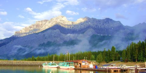
Devils Gorge Dam in Lake Minnewanka Near Banff, Alberta Canada
July 92018

N 51° 14.778′ W 115° 29.780′ The Devils Gorge Dam is actually 3 separate dams. I parked the truck and unloaded my gear from the top of the new dam. The top of the one I was diving on was 45′ below the surface of the lake. This dam was built in 1916 to raise the lake even higher than the original 1800’s dam farther out and even deeper. There is also a submerged town in this lake. The lake is at 5,000′ above sea level.
More Information»
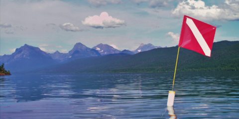
Gertrude Sternwheeler Shipwreck in Upper Waterton Lake at Alberta, Canada
July 72018

N 49° 3.375′ W 113° 54.549′ The Gertrude is a 70′ long wood sternwheeler that sank in Upper Waterton Lake just North of Glacier National Park. The stern is at 20′ and the bow is at 60′ The visibility varies but it was about 20′ when I dove it, This lake is at 4,200′ above sea level so you need to be careful to not drive to a higher elevation within 24 hours after diving here.
More Information»
Fish Creek in Lake McDonald at Glacier National Park, Montana
July 72018

N 48° 32.843′ W 113° 58.841′ Fish Creek is on the North side of Lake McDonald in Glacier National Park, Montana. The lake is 3,156′ above sea level so I needed to stay this side of Logan Pass for 24 hours after diving here. The visibility was about 40′ here.

More Information»
Apgar in Lake McDonald at Glacier National Park, Montana
July 72018

N 48° 31.846′ W 113° 58.788′ At Apgar in Lake McDonald, the bottom is a fine gravel and the water is pretty clear. The glacial lake is 3,156′ above sea level so I needed to stay on this side of Logan pass for 24 hours after diving. I found 4 golf balls, a clear bottle, and 2 broken plates. I only went down to 25′ deep.

More Information»
Horse Thief Lake at Mt Rushmore

Horse Thief Lake at Mt Rushmore

N 43° 53.635' W 103° 28.942'

July 72018

N 43° 53.635′ W 103° 28.942′ Horse Thief Lake is about 1 1/2 miles NW of Mount Rushmore. I dove here in 2009 thinking it has probably never been dove. I used High Altitude dive tables as the lake is 5,000′ above sea level. The bottom was silty and the visibility was less than 5′. I found a couple lures and that was it.

More Information»
Pontoon in Roosevelt Lake at Outing, MN

Pontoon in Roosevelt Lake at Outing, MN

N 46° 49.661' W 93° 56.604'

July 72018

N 46° 49.661′ W 93° 56.604′ The pontoon sank in 1969 when a big tornado came across the lake. Bill Mathies (PADI #79) who owns Minnesota School of Diving recovered two of the 11 people that died during the storm.
The visibility was about 10′ and the water was stained. There was a lot of other debris in the water from the cabins that blew into the lake.

More Information»
Poplar Lake on the Gunflint Trail near the Canadian Border
July 62018

N 48° 2.883′ W 90° 30.288′ Poplar Lake is in the boundary Waters Canoe Area, but it is the last lake that you can use a motorized boat in. The water is stained from the tannic acid, but I wanted to dive it anyway. I dropped down to about 50′ and the visibility was only about 5′ to 10′.

More Information»
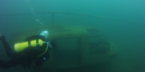
Scuba Palooza in Lake Ore-B-Gone at Gilbert, MN

Scuba Palooza in Lake Ore-B-Gone at Gilbert, MN

N 47° 29.042' W 92° 27.817'

July 62018

N 47° 29.042′ W 92° 27.817′ Scuba Palooza is a two day annual treasure dive event that brings divers from all over Minnesota to find underwater medallions, watch home videos of dives, eat BBQ, camp, and just hang out. It is at the Sherwood Forest Campground at Gilbert, MN.
More Information»

N 47° 28.736′ W 92° 27.555′ There are 3 lines at this buoy. One leads to a twin engine plane, the next leads to a Huey Chopper, and the 3rd one leads to a 1940’s car. They are between 25′ and 40′ deep. The visibility here varies from 20′ to 40′.

More Information»
Rail Truck in Lake Ore-B-Gone at Gilbert, MN

Rail Truck in Lake Ore-B-Gone at Gilbert, MN

N 47° 28.881' W 92° 27.794'

July 62018

N 47° 28.881′ W 92° 27.794′ The Rail truck is like a pick up truck that would run on the rails to haul small train cars into and out of the mine pit. These were electric and ran of a series of batteries under the bed. The rail truck is sitting in 28′ deep water straight out from where the kids would jump off the cliff. The visibility here is about 20′.

More Information»
Speeder #2 in Lake Ore-B-Gone at Gilbert, MN

Speeder #2 in Lake Ore-B-Gone at Gilbert, MN

N 47° 28.894' W 92° 27.745'

July 62018

N 47° 28.894′ W 92° 27.745′ Rail Speeder #2 is a gas powered rail car made to transport miners in and out of the open pit mine. There are two of these in Lake Ore-B-Gone but this one is at 21′ deep. The visibility here is about 25′.

More Information»
Speeder #1 in Lake Ore-B-Gone at Gilbert, MN

Speeder #1 in Lake Ore-B-Gone at Gilbert, MN

N 47° 28.897' W 92° 27.726'

July 62018

N 47° 28.897′ W 92° 27.726′ Rail Speeder #1 is a gas powered rail car made to transport miners in and out of the open pit mine. There are two of these in Lake Ore-B-Gone but this one is at 20′ deep. The visibility here is about 25′.

More Information»
Fiberglass Boat in Lake Ore-B-Gone at Gilbert, MN
July 62018

N 47° 28.895′ W 92° 27.713′ This fiberglass boat is sitting on a rocky slope just off the swimming beach in 40 deep water. Because the mine pit is 433′ deep, the water can be chilly at depth. The visibility here is about 25′.

More Information»
Army Trainer Plane in Lake Ore-B-Gone at Gilbert, MN
July 62018

N 47° 28.895′ W 92° 27.695′ The small single engine Army trainer plane is sitting on a rocky slope at 41′ deep. The canopy is open but it is too tight to fit a diver in there. Because the mine pit is 433′ deep, the water can be chilly at depth. Visibility here is about 25′.

More Information»
Skeleton on Water Pump in Lake Ore-B-Gone at Gilbert, MN
July 62018

N 47° 28.908′ W 92° 27.673′ This fake skeleton is sitting on a pump platform at 52′ deep. Someone in the past dressed it up in scuba gear and sat it on a lawn chair. The visibility here is about 25′ Because the mine pit is 433′ deep, the water is chilly here at depth.

More Information»
Jeep CJ5 in Lake Ore-B-Gone at Gilbert, MN

Jeep CJ5 in Lake Ore-B-Gone at Gilbert, MN

N 47° 29.022' W 92° 27.684'

July 62018

N 47° 29.022′ W 92° 27.684′ I think this Jeep in the water was an accident based on the crumpled condition and the steep hill it rolled down. It is in 15′ of water. The visibility here is about 30′.

More Information»
Gunship Helicopter in Lake Ore-B-Gone at Gilbert, MN
July 62018

N 47° 29.038′ W 92° 27.667′ This is a helicopter that has a replica mini-gun mounted on the nose. It is sitting at 35′ deep but because the mine pit is 433′ deep, the dives here are chilly. Visibility is about 40′.

More Information»
School Bus in Lake Ore-B-Gone at Gilbert, MN

School Bus in Lake Ore-B-Gone at Gilbert, MN

N 47° 29.073' W 92° 27.642'

July 62018

N 47° 29.073′ W 92° 27.642′ The School bus is silver and maroon and its sitting on a 45 degree slope from back to front. The back is at 54′ deep and the front is at 40′ deep. The back door is open so you can swim through it. Visibility here is about 40′. This is a deep mine pit at 433′ deep so the water temps are usually chilly at depth.

More Information»
St. James Mine Pit Wall Dive

St. James Mine Pit Wall Dive

N 47° 32.077' W 92° 13.799'

July 42018

N 47° 32.077′ W 92° 13.799′ The wall is just East of the boat launch in St. James mine pit. Although the mine pit is 381′ deep the wall drops to 220′. I only went down to about 110′ but the visibility was so good, I didn’t need a light at that depth. Visibility was about 50′.

More Information»
Submerged Buildings in Lake Mine Near Biwabik, MN
July 32018

N 47° 32.381′ W 92° 17.141′ Although the mine pit is 465′ deep, these submerged buildings sit at 75′ deep on top of a ledge that drops very deep. The visibility was about 35′

More Information»
Small Wood Boat in Pike Lake at Hermantown, MN

Small Wood Boat in Pike Lake at Hermantown, MN

N 46° 51.829' W 92° 17.928'

July 32018

N 46° 51.829′ W 92° 17.928′ A small wood boat probably from the 40’s or 50’s on the south shore of Pike Lake near Hermantown, MN. It is sitting in about 6″ of silt at about 25′ deep. The visibility was only about 10′ max.

More Information»
Halvor Reiten Park in Lake Superior at Bayfield, WI
July 22018

N 46° 48.435′ W 90° 49.012′ This is a shore dive just off Bodins Fish Market and the public beach at Halvor Reiten Park in Bayfield Wisconsin. There is a lot of slab wood and a few shipwreck timbers in the water just off this beach. There is supposed to be a submerged Model A just of the Bodins Fish Market Dock as well but I did not find it.

More Information»
Railroad Graveyard in Lake Superior at Duluth, MN
July 22018

N 46° 47.252′ W 92° 5.404′ This is a submerged 900′ long wood dock that trains used to run on to load and unload ships. Toward the end of its useful life, the railroad would take train cars full of junk train parts and roll them into the water from the dock. Not much is left in the way of train parts but a few pieces remain.

More Information»
The Breakwall in Lake Superior at Two Harbors, MN
July 22018

N 47° 0.710′ W 91° 40.661′ There are two breakwalls in Two Harbors. This one is the inside of the Southern one. It consists of wood, rock, steel, and concrete and was built inadvertently on top of part of a shipwreck called the Ely. This is a good place to dive if you get blown out of the main lake.
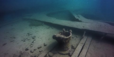
More Information»
Samuel P. Ely Shipwreck in Lake Superior at Two Harbors, MN

Samuel P. Ely Shipwreck in Lake Superior at Two Harbors, MN

Shipwreck Dive N 47° 0.700' W 91° 40.677'

July 22018

N 47° 0.700′ W 91° 40.677′ The Ely is a 200′ wood three masted schooner-barge that sank in 1896 in Two Harbors, MN. The tugboat Edna G that is still moored in Two Harbors rescued the 10 crew members from the Ely. The wreck is in 30′ of water and about 30′ of the stern is buried under the breakwall. Visibility here ranges from 2′ to 10′ because of the traffic in the harbor.

More Information»
Gooseberry Falls in Lake Superior

Gooseberry Falls in Lake Superior

N 47° 8.444' W 91° 27.298'

July 22018

N 47° 8.444′ W 91° 27.298′ Gooseberry Falls caverns is a wall dive with several small sea-caves There is a 15′ high cliff that you can use for the giant stride entry and the wall drops about 30 deep before ‘flattening out’ to a 45 degree rocky slope. Exiting the area just North on a rocky beach can be interesting in rough water.
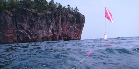
More Information»
Madeira Shipwreck in Lake Superior at Gold Rock Point

Madeira Shipwreck in Lake Superior at Gold Rock Point

Shipwreck Dive N 47° 12.354' W 91° 21.458'

July 22018

N 47° 12.354′ W 91° 21.458′ The Madeira is a 436′ steel 3 masted schooner-barge that sank in 1905 off Gold Rock Point just north of Split Rock Lighthouse. The bow is between 40 and 50′ deep. The stern is at 65′, & the pilot house was at 75′ but now what’s left of it is at 100′. There is a large debris field just north of the Stern section.
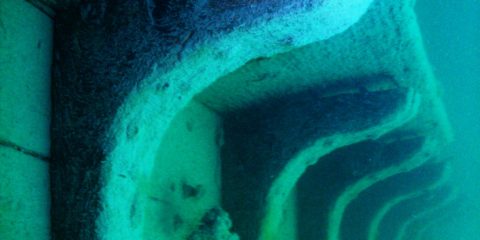
More Information»
The Hesper Shipwreck in Lake Superior at Silver Bay, MN

The Hesper Shipwreck in Lake Superior at Silver Bay, MN

Shipwreck Dive N 47° 16.295' W 91° 16.232'

July 22018

N 47° 16.295′ W 91° 16.232′ The Hesper was a 250′ wooden-hulled, single-screw, triple-masted, cargo ship that sank in Silver Bay, MN in 1905. The ships hull is split open and the sides are laying in a “V” shape. The bow is in 30′ of water and the rudder is at 48′. Visibility here is seldom over 30 because of the proximity of the harbor traffic.

More Information»
Cave of the Winds in Lake Superior at Ilgen, MN

Cave of the Winds in Lake Superior at Ilgen, MN

N 47° 20.851' W 91° 11.028'

July 22018

N 47° 20.851′ W 91° 11.028′ This natural cave is at a location where Minnesota Mining & Manufacturing (3M) had a dock in Ilgen, MN (town is no longer there). The cave entry is right next to the rocky beach and after a 75′ swim-thru, the exit is on the lake side of the cliff. The cave itself is open to the air all the way through. There are remains of the 3M dock here to explore as well.

More Information»
Grand Marais Harbor, Lake Superior, MN

Grand Marais Harbor, Lake Superior, MN

N 47° 44.809' W 90° 20.084'

July 12018

N 47° 44.809′ W 90° 20.084′ This is a shallow shore dive in Grand Marais Harbor. There wasn’t much to see except logs, rocks, Things lost of Moored sailboats, and the occasional shipwreck timber.
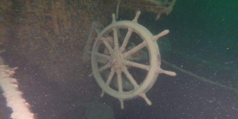
More Information»
The Kamloops Stern Shipwreck in Lake Superior at Isle Royale, MI

The Kamloops Stern Shipwreck in Lake Superior at Isle Royale, MI

Shipwreck Dive N 48° 5.118' W 88° 46.000'

June 302018

N 48° 5.118′ W 88° 46.000′ The Kamloops is a 250′ steel canaler that sank in 1927 near Isle Royale. It’s resting on the bottom at 270′ deep, but the top of the stern is at 180′ deep The top of the bow is at 240′ deep. This is a deep wreck well beyond recreational limits, and it is a wreck to be respected.

More Information»
Isle Royale Above the Surface…

Isle Royale Above the Surface…

N 47° 54.725' W 89° 9.511'

June 302018

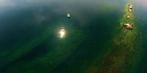
N 47° 54.725′ W 89° 9.511′ There are many places to dock for the night around Isle Royale. Windigo at one end and Rock Harbor at the other… both offer fuel and showers. There are several other smaller docks around the island in sheltered bays. Most of these areas have 8′ by 16′ shelters that anyone can stay in free for up to 3 days at a time on a first come-first serve basis.
More Information»
Henry Chisholm Engine Shipwreck in Lake Superior at Isle Royale, MI

Henry Chisholm Engine Shipwreck in Lake Superior at Isle Royale, MI

Shipwreck Dive N 47° 51.450' W 89° 19.796'

June 302018

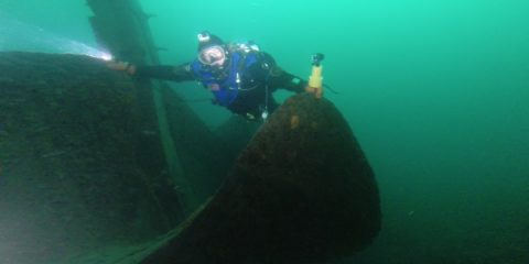
N 47° 51.450′ W 89° 19.796′ The Henry Chisholm was a wooden bulk freighter that sank in 1898 near Rock of Ages Lighthouse at Isle Royale. The 30′ tall engine sits in 115′ deep water and the 12′ diameter prop is at 155′ deep. The visibility here is between 30′ to 40′ and the water is usually around 40 degrees.
More Information»
George M. Cox Shipwreck in Lake Superior at Isle Royale, MI

George M. Cox Shipwreck in Lake Superior at Isle Royale, MI

Shipwreck Dive N 47° 51.462' W 89° 19.385'

June 282018

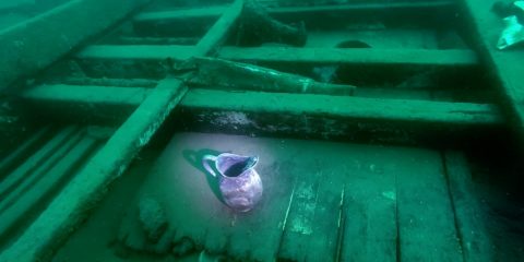
N 47° 51.462′ W 89° 19.385′ The George M. Cox shipwreck (also called ‘Cox on the Rocks’) is a 233′ steel passenger ship that sank in 1933 near Isle Royale. The bow is in 10′ of water and the stern is 100′ deep. The visibility here is about 40′ mostly and the water temps are generally in the 40’s.
More Information»
The Monarch Shipwreck in Lake Superior at Isle Royale, MI

The Monarch Shipwreck in Lake Superior at Isle Royale, MI

Shipwreck Dive N 48° 11.334' W 88° 25.957'

June 282018

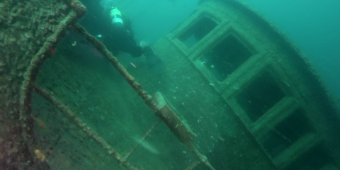
N 48° 11.334′ W 88° 25.957′ The Monarch Shipwreck is a 259′ wood packet ship that sank in 1906 near Isle Royale. It is broken up between 10′ deep to 80′ deep. There is nothing left to penetrate on this wood wreck as the hull is layed open and artifacts are scattered across the site. Visibility is 25′ to 40′ and the water temp is around 45 degrees.
More Information»
Chester A. Congdon Shipwreck in Lake Superior at Isle Royale, MI

Chester A. Congdon Shipwreck in Lake Superior at Isle Royale, MI

Shipwreck Dive N 48° 11.559' W 88° 30.815'

June 282018

N 48° 11.559′ W 88° 30.815′ The Chester A. Congdon Bow Shipwreck is the bow section of a 526′ long 56′ wide bulk freighter that sank in 1918 near Isle Royale. The site is from 60′ to 120′ deep and has 4 levels to explore. The bow sits at a 45 degree angle and some call it ‘the fun house’ because of this. Visibility here is usually 30′ with bottom temps about 40 degrees.
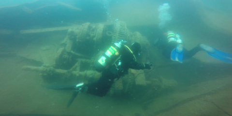
More Information»
The Emperor Bow Shipwreck in Lake Superior at Isle Royale, MI

The Emperor Bow Shipwreck in Lake Superior at Isle Royale, MI

Shipwreck Dive N 48° 12.003' W 88° 29.525'

June 282018

N 48° 12.003′ W 88° 29.525′ The Emperor was 525 feet long, 56 feet in beam. It was hauling 10,000 tons of iron ore when it sank in 1947 just North of Isle Royale. 12 sailors died in this wreck. The sand at the Bow is at 60′. The ‘swim through’ at the turning point for this bow dive is at 93′ deep. At this ‘swim through’ you cross under the 56′ wide hull of the ship. The water is usually about 45 degrees. The visibility is about 40′.
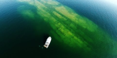
More Information»
The Emperor Stern Shipwreck in Lake Superior at Isle Royale, MI

The Emperor Stern Shipwreck in Lake Superior at Isle Royale, MI

Shipwreck Dive N 48° 12.018' W 88° 29.606'

June 282018

N 48° 12.018′ W 88° 29.606′ The Emperor was 525 feet long, 56 feet in beam. It was hauling 10,000 tons of iron ore when it sank in 1947 just North of Isle Royale. 12 sailors died in this wreck. The sand at the stern is at 180′. The Engine room is at 150′, and the fantail is at 135′ deep. This is one of the best wrecks in the Great Lakes in my opinion. The water is usually about 45 degrees. The visibility is about 40′.
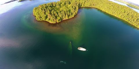
More Information»
The America Shipwreck in Lake Superior at Isle Royale, MI

The America Shipwreck in Lake Superior at Isle Royale, MI

Shipwreck Dive N 47° 53.631' W 89° 13.341'

June 282018

N 47° 53.631′ W 89° 13.341′ The America wreck is 180′ long and sank in 1928. The bow is 2′ below the surface and the stern is 80′ below the surface. This is a shallow wreck in fairly cold water. Average water temperatures here in the summer are between 40 and 50 degrees. Visibility varies, but 30′ to 50′ is common.

More Information»
All Listing Types All Locations Any Rating

Listing Results

  • Voici Bernadette Wreck

    Artificial Reef, Jewfish, lionfish, Mutton Snapper, Snook

    Read more
  • Ft Zack – Shore Dive –

    Chunky Bottom, Grunts, Hogfish, Mangrove Snapper, Red Grouper, Snapper, Spiny Lobster, Yellowtail Snapper

    Read more
  • Lob Flounder –

    Flounder, Ledge, Mangrove Snapper, Spiny Lobster

    Read more
  • Lobs Greys Trigs –

    Amberjack, Bait, Flounder, Gag Grouper, Ledge, Spiny Lobster

    Read more
  • AJ Barge –

    Amberjack, Artificial Reef, Bait, Mangrove Snapper, Wreck

    Read more
  • Permit Barge –

    Artificial Reef, Jewfish, Wreck

    Read more
  • FSFA Artificial Reef Site #2 –

    Amberjack, American Red Snapper, Artificial Reef, Barracuda, Cobia, Flounder, Gag Grouper, Jacks, Mangrove Snapper, Reef Fish, Sheephead, Snapper

    Read more
  • GOM – Pipeline – Reel Animals TV –

    Mangrove Snapper, Natural Gas Pipeline

    Read more
  • Shark Chute – Belize –

    Coral Reef, lionfish, Reef Fish, Tropical Fish

    Read more
  • The Big One – Belize –

    Coral Reef, lionfish

    Read more
  • Paso Del Cedral – Cozumel –

    Coral Reef

    Read more
  • Yucav – Cozumel –

    Coral Reef, Reef Fish, Spiny Lobster

    Read more
  • Bayronto Wreck –

    Amberjack, Bait, Gag Grouper, Grunts, Jacks, Jewfish, Mangrove Snapper, Scamp Grouper, Snapper, Wreck

    Read more
  • Mr Bud – Roatan Honduras –

    Tropical Fish, Wreck

    Read more
  • Mary’s Place – Roatan Honduras –

    Coral Reef, Cubera Snapper, Jacks, Ledge, Reef Fish, Yellowfin Grouper

    Read more
  • Black Triggerfish Reef –

    Coral Reef, Triggerfish, Tropical Fish

    Read more
  • Three Sisters –

    Bait, Chez Rock, Gag Grouper, Grunts, Hogfish, Ledge, Mangrove Snapper, Red Grouper, Snapper, Tropical Fish

    Read more
  • Isla Tortuga – Costa Rica –

    Tropical Fish

    Read more
  • Cayo Sal – Caraballeda Venezuela –

    Artificial Reef, Grunts, Snapper, Spadefish, Tropical Fish

    Read more
  • Tropic Star Boat Dock –

    Boat Dock, Jacks, Snapper, Tropical Fish

    Read more
  • Mountain Point – Ketchikan Alaska

    Bull Whip Kelp, Rock Fish, Sea Star

    Read more
  • Abandoned Boat – Panama –

    Artificial Reef, Bait, Black Marlin, Dolphin Fish, Triggerfish

    Read more
  • Concrete Pilings –

    Artificial Reef

    Read more
  • Grand Canyon – El Tovar

    Ledge

    Read more
  • Sinkhole Wreck –

    Amberjack, Chris Hudgens, Gag Grouper, Grunts, Hogfish, Jacks, Jewfish, Mangrove Snapper, Reef Fish, Scamp Grouper, Spadefish, Wreck

    Read more
  • Reel Animals Grouper Rocks –

    Artificial Reef, Gag Grouper, Grunts, Hogfish, Mangrove Snapper, Rock Pile

    Read more
  • Fish Traps Big Pine –

    Hogfish, Reef Fish

    Read more
  • B S Wreck –

    Chris Hudgens, Gag Grouper, Mangrove Snapper, Red Grouper, Wreck

    Read more
  • Lobster Fuel Tank –

    Artificial Reef, Mangrove Snapper, Spiny Lobster

    Read more
  • Lobster Car Hood –

    Artificial Reef, Lobster, Spiny Lobster

    Read more
  • American Shoal –

    Barracuda, Black Grouper, Coral Reef, Grunts, Hogfish, Jacks, Mangrove Snapper, Mutton Snapper, Reef Fish, Snapper, Spiny Lobster, Tropical Fish

    Read more
  • Yoza –

    Bait, Gag Grouper, Grunts, Hogfish, Mangrove Snapper, Red Grouper, Reef Fish, Rock Pile

    Read more
  • Blue Marlin Surprise –

    Blue Marlin

    Read more
  • Yep –

    Chris Hudgens, Coral Reef, Ledge, Mangrove Snapper

    Read more
  • Donny Barge South –

    Amberjack, American Red Snapper, Wreck

    Read more
  • Donny Barge North –

    Amberjack, American Red Snapper, B Lang, Gag Grouper, Wreck

    Read more
  • Big Pine Shallow Bait –

    Bait, Spiny Lobster

    Read more
  • Egmont Barge (Name?) –

    Hogfish, Mangrove Snapper, Wreck

    Read more
  • Greek –

    Amberjack, Chris Hudgens, Hogfish, Jacks, Mangrove Snapper

    Read more
  • Coalbin Rock Area –

    Coral Reef, Hogfish, Mangrove Snapper, Snapper

    Read more
  • Delila – Cozumel –

    Black Grouper, Coral Reef, Cubera Snapper, Reef Fish

    Read more
  • Egmont Mango –

    Chez Rock, Gag Grouper, Hogfish, Ledge, Mangrove Snapper

    Read more
  • SM1 – Air Force Tower –

    Amberjack, American Red Snapper, Bait, Barracuda, Cobia, Dark Island Fishing Team, Gag Grouper, Jewfish, Mangrove Snapper

    Read more
  • JLB Pelican Shoal –

    Coral Reef, Spiny Lobster

    Read more
  • Capt Ben Flounder Sinkhole –

    American Red Snapper, Bait, Dark Island Fishing Team, Dead Spring, Gag Grouper, Sink Hole

    Read more
  • Tormentos – Cozumel –

    Coral Reef, Reef Fish, Tropical Fish

    Read more
  • 9 Mile Reef Sandbar –

    Eel Grass, Sandbar, Turtle Grass

    Read more
  • Columbia Deep – Cozumel –

    Cave, Coral Reef, Cubera Snapper, Mutton Snapper, Tropical Fish

    Read more
  • John K Drone –

    American Red Snapper, Bait, Gag Grouper, John K, Wreck

    Read more
  • Troy Thompson Scallop –

    Bay Scallops, Eel Grass, Turtle Grass

    Read more
  • Capt Ben Good Scallop –

    Bay Scallops, Eel Grass, Turtle Grass

    Read more
  • Lake Baikal –

    Freshwater

    Read more
  • Six Pack Ledge –

    American Red Snapper, Gag Grouper, Grunts, Hogfish, Jacks, Jewfish, Kevin Bruington, Ledge, lionfish, Mangrove Snapper

    Read more
  • Incredible Sinkhole –

    American Red Snapper, Cave, Dead Spring, Gag Grouper, Grunts, Jacks, Jewfish, John K, lionfish, Mangrove Snapper, Sink Hole

    Read more
  • Capt Ben Ledge –

    Dark Island Fishing Team, Gag Grouper, Grunts, Hogfish, Ledge, Mangrove Snapper

    Read more
  • Steinhatchee Artificial Reef Culverts –

    Artificial Reef, Dark Island Fishing Team, Gag Grouper, Grunts, Jewfish, Mangrove Snapper, Sheephead

    Read more
  • JK 152 RS –

    American Red Snapper, Chunky Bottom, Gag Grouper, Ledge

    Read more
  • 80 Wreck –

    American Red Snapper, Bait, Cobia, Gag Grouper, Hogfish, lionfish, Mangrove Snapper, Shark, Wreck

    Read more
  • Sapona Wreck –

    Bait, Barracuda, Grunts, Hogfish, Jacks, lionfish, Mangrove Snapper, Reef Fish, Snapper, Tropical Fish, Wreck

    Read more
  • Bimini Barge Wreck –

    Grunts, Jacks, lionfish, Mangrove Snapper, Reef Fish, Tropical Fish, Wreck

    Read more
  • College Rock –

    Bait, Gag Grouper, Jewfish, Rock Pile

    Read more
  • Chichen – Itza

    Megalithic Structure

    Read more
  • Alachua Sink –

    Sink Hole

    Read more
  • Panacea Barge Wreck –

    Amberjack, Dark Island Fishing Team, Gag Grouper, Grunts, Jacks, Jewfish, Mangrove Snapper, Wreck

    Read more
  • MV Adolphus Busch Wreck –

    Amberjack, Artificial Reef, Black Grouper, Jacks, Jewfish, Mangrove Snapper, Mutton Snapper, Reef Fish, Snook

    Read more
  • Hog Reef –

    Chunky Bottom, Hogfish

    Read more
  • Scamps Hog Up High –

    Hogfish, Scamp Grouper

    Read more
  • Scattered Bait Rock –

    Bait, Scattered Rock

    Read more
  • East Chicken Coups –

    American Red Snapper, Artificial Reef, Gag Grouper, John K

    Read more
  • West Chicken Coups –

    American Red Snapper, Artificial Reef, Gag Grouper, John K

    Read more
  • RS Horseshoe –

    American Red Snapper, Ledge

    Read more
  • Rick Ruth –

    Ledge, Spiny Lobster

    Read more
  • Vis Check Mini –

    Ledge, Spiny Lobster

    Read more
  • High Side Left Ledge –

    Ledge, Spiny Lobster

    Read more
  • 087 Snap Lob –

    Ledge, Spiny Lobster

    Read more
  • 0535 Ninja Ruth –

    Ledge

    Read more
  • 509 Rock –

    Amberjack, Bait, Black Grouper, Gag Grouper, Jewfish, Ledge, Scamp Grouper, Shark, Triggerfish

    Read more
  • Porta Allegra (Lobster Wreck)-

    American Red Snapper, Gag Grouper, Lobster, Scamp Grouper, Yellowmouth Grouper

    Read more
  • Mushroom Rock –

    Hogfish, Ledge

    Read more
  • Playground –

    Ledge

    Read more
  • Twins –

    Chris Hudgens, Gag Grouper, Ledge, Mangrove Snapper, Reef Fish, Snapper, Tropical Fish

    Read more
  • JP 005 –

    Gag Grouper, Hogfish, Rock Pile

    Read more
  • JP 009 –

    Gag Grouper, Grunts, Hogfish, Ledge, Mangrove Snapper

    Read more
  • 1669 Mango –

    Gag Grouper, Hogfish, Mangrove Snapper, Sheephead

    Read more
  • Sal Big Black Grouper –

    Black Grouper

    Read more
  • Big Big Cave –

    Amberjack, American Red Snapper, Cobia, Dead Spring, Gag Grouper, John K, lionfish, Mangrove Snapper, Sink Hole

    Read more
  • Flat Rock –

    Flat Rock, Gag Grouper, John K

    Read more
  • Bruce 2 Gags –

    Gag Grouper, Rock Pile

    Read more
  • 90FT Shrimp Boat Wreck –

    Amberjack, American Red Snapper, Cobia, Dark Island Fishing Team, Gag Grouper, Jacks, Jewfish, lionfish, Mangrove Snapper, Wreck

    Read more
  • Mitchel Wreck (Tug Boat) –

    Amberjack, American Red Snapper, Barracuda, Dark Island Fishing Team, Gag Grouper, Jacks, Jewfish, lionfish, Mangrove Snapper, Wreck

    Read more
  • Axel –

    Amberjack, Chris Hudgens, Gag Grouper, Ledge, Mangrove Snapper

    Read more
  • Pipe Hog –

    Hogfish, Natural Gas Pipeline

    Read more
  • Collector (Artificial Reef)-

    Artificial Reef, B Lang, Cobia, Gag Grouper, Jacks, Mangrove Snapper, Whale Shark

    Read more
  • Galactica –

    Amberjack, Chris Hudgens, Jewfish, lionfish, Wreck

    Read more
  • Looe Key Reef –

    Black Grouper, Coral Reef, Mangrove Snapper, Snapper, Tropical Fish

    Read more
  • Molasses Reef –

    Coral Reef, Mangrove Snapper, Reef Fish, Snapper

    Read more
  • JP 007 –

    Cave, Gag Grouper, Grunts, Hogfish, Mangrove Snapper, Red Grouper, Reef Fish, Scamp Grouper, Snapper, Tropical Fish

    Read more
  • Rhino Ledge –

    Amberjack, American Red Snapper, Gulf of Mexico, Kevin Bruington, Ledge

    Read more
  • The Gwalia – Middle Grounds Tugboat Wreck –

    Amberjack, Cobia, Gag Grouper, Jacks, Mangrove Snapper, Wreck

    Read more
  • Three Sisters –

    Ledge

    Read more
  • Fezon Sinkhole –

    American Red Snapper, Gag Grouper, Grunts, Jacks, Jewfish, Kevin Bruington, lionfish, Sink Hole

    Read more
  • U-2513 (WWII German U-Boat) –

    Amberjack, Jacks, Jewfish, lionfish, Wreck

    Read more
  • Walkers Reef –

    Coral Reef, Tropical Fish

    Read more
  • B-Lang Hog to Jack Head –

    Coral Reef, Hogfish, Tropical Fish

    Read more
  • Big Black –

    Black Grouper, Cave, Coral Reef, Cubera Snapper, Mutton Snapper, Rock Pile, Shark, Snapper, Tropical Fish

    Read more
  • Coral Heads 2 -1

    Coral Reef, Tropical Fish

    Read more
  • 5000 Snapper –

    Ledge, Middle Grounds

    Read more
  • Holey Rock –

    Ledge, Middle Grounds

    Read more
  • MV Holstein – (aka Flour Wreck)-

    Amberjack, Gag Grouper, Wreck

    Read more
  • Lady Ora –

    Chez Rock, Ledge, Middle Grounds

    Read more
  • Jerry Chez –

    Chez Rock, Hogfish, Middle Grounds, Turtle

    Read more
  • Jack Boat Ledge –

    Amberjack, Ledge, Middle Grounds

    Read more
  • Harvey Killer Chez –

    Chunky Bottom, Coral Reef, Gag Grouper, Kevin Bruington, Ledge, Mangrove Snapper, Middle Grounds, Red Grouper, Reef Fish, Tropical Fish

    Read more
  • Tiger 8+ –

    Coral Reef, Reef Fish, Tiger Grouper, Tropical Fish

    Read more
  • Lobster Reef –

    Coral Reef, Lobster, Tropical Fish

    Read more
  • Small Hog Reef –

    Coral Reef, Hogfish, Tropical Fish

    Read more
  • 0088 CH –

    Coral Reef, Hogfish, Tropical Fish

    Read more
  • BHogg to 4489 –

    Coral Reef, Hogfish, Tropical Fish

    Read more
  • GR Ledge –

    Coral Reef, Cubera Snapper, Ledge, Snapper, Tropical Fish

    Read more
  • Good Roc1 –

    Coral Reef, Reef Fish

    Read more
  • Holey Carbo –

    Ledge, Middle Grounds

    Read more
  • Gully Break –

    Ledge, Middle Grounds

    Read more
  • Gully –

    Ledge, Middle Grounds

    Read more
  • GS2 – Scar Faced Hog –

    Hogfish, Ledge, Middle Grounds

    Read more
  • Go Factory –

    Amberjack, Chez Rock, Chunky Bottom, Gag Grouper, Hogfish, Mangrove Snapper, Middle Grounds, Reef Fish, Tropical Fish

    Read more
  • Goat Cracks –

    Ledge, Middle Grounds, Reef Fish

    Read more
  • Firemouth –

    Cave, Chunky Bottom, Gag Grouper, Ledge, Middle Grounds, Yellowfin Grouper, Yellowmouth Grouper

    Read more
  • Dusk Hog –

    Middle Grounds

    Read more
  • Deco Time –

    Middle Grounds

    Read more
  • Dancing Hog –

    Middle Grounds

    Read more
  • Boulder Canyon –

    Ledge, Middle Grounds

    Read more
  • Big On Top –

    Middle Grounds

    Read more
  • Big Dirty –

    Ledge

    Read more
  • Head Start Wreck (Shrimp Boat) –

    American Red Snapper, Gag Grouper, Wreck

    Read more
  • Cozumel –

    Amberjack, American Red Snapper, Chunky Bottom, Gag Grouper, Hogfish, Ledge, Mangrove Snapper, Middle Grounds, Red Grouper, Reef Fish, Scamp Grouper, Tropical Fish

    Read more
  • Flower Garden –

    Amberjack, American Red Snapper, Chez Rock, Chunky Bottom, Coral Reef, Gag Grouper, Grunts, Hogfish, Jewfish, Kevin Bruington, Mangrove Snapper, Middle Grounds, Red Grouper, Reef Fish, Scamp Grouper, Snapper, Triggerfish

    Read more
  • Mikes Pair –

    Hogfish, Ledge, Middle Grounds

    Read more
  • Tenneco Towers Wreck (Oil Platforms) –

    Artificial Reef, Paul Varian

    Read more
  • Dantor Wreck –

    Artificial Reef, Paul Varian, Wreck

    Read more
  • Trio Bravo Wreck –

    Artificial Reef, Paul Varian, Wreck

    Read more
  • Tracor Wreck (Dry Dock) –

    Artificial Reef, Paul Varian, Wreck

    Read more
  • Ande Wreck –

    Artificial Reef, Paul Varian, Wreck

    Read more
  • Skycliff Wreck –

    Artificial Reef, Paul Varian, Wreck

    Read more
  • Rodeo 25 Wreck (Nore) –

    Artificial Reef, Paul Varian, Wreck

    Read more
  • Dewitt Clinton Wreck –

    Artificial Reef, Paul Varian, Wreck

    Read more
  • Johnny Morris Wreck –

    Artificial Reef, Wreck

    Read more
  • Hydro Atlantic Wreck

    Wreck

    Read more
  • Cruz Del Sur Wreck –

    Artificial Reef, Wreck

    Read more
  • M/V Castor Wreck –

    Artificial Reef, Wreck

    Read more
  • Ft Jefferson –

    Coastal Fortress

    Read more
  • Eagle Wreck –

    Barracuda, Black Grouper, Mangrove Snapper, Reef Fish, Tropical Fish, Wreck

    Read more
  • USCGC Duane Wreck –

    Black Grouper, Jewfish, Mangrove Snapper, Reef Fish, Wreck

    Read more
  • USS Curb Wreck –

    Black Grouper, Cubera Snapper, Mutton Snapper, Wreck

    Read more
  • Cayman Salvager Wreck –

    Barracuda, Black Grouper, Tropical Fish, Wreck

    Read more
  • Thunderbolt Wreck –

    Amberjack, Artificial Reef, Black Grouper, Hogfish, Jacks, Jewfish, Mangrove Snapper, Mutton Snapper, Wreck

    Read more
  • Tom G Snapper Ledge –

    Gag Grouper, Hogfish, Ledge, Mangrove Snapper, Red Grouper

    Read more
  • USS Spiegel Grove –

    Black Grouper, Grunts, Reef Fish, Wreck

    Read more
  • Captain Gil Tug –

    Amberjack, Cobia, Gag Grouper, Jewfish, Mangrove Snapper, Wreck

    Read more
  • South Jack Hole –

    Amberjack, Dead Spring, Gag Grouper, Jewfish, Mangrove Snapper, Sink Hole

    Read more
  • Devils Ledge –

    Amberjack, American Red Snapper, Bait, Dark Island Fishing Team, Dead Spring, Gag Grouper, Jewfish, Ledge, Mangrove Snapper

    Read more
  • Lamb Spring –

    Amberjack, Dead Spring, Jewfish, Sink Hole

    Read more
  • Carrabelle Cave –

    Dead Spring, Gag Grouper, Sink Hole

    Read more
  • Ultimate Dive – Ulti –

    Middle Grounds

    Read more
  • No Shark – FMG –

    Middle Grounds

    Read more
  • Ruthie Hog – FMG –

    Middle Grounds

    Read more
  • Super Grouper – FMG –

    Middle Grounds

    Read more
  • Sand Tiger Canyon – FMG –

    Ledge, Middle Grounds, Shark

    Read more
  • Tommy ARS – FMG –

    American Red Snapper, Chez Rock, Gag Grouper, Jewfish, Mangrove Snapper, Middle Grounds

    Read more
  • Show Jerry – FMG –

    Middle Grounds

    Read more
  • Nate Bait – FMG –

    Middle Grounds

    Read more
  • Magic Mushroom – FMG –

    Amberjack, Cubera Snapper, Gag Grouper, Middle Grounds, Rock Pile

    Read more
  • Pipes – FMG –

    Amberjack, Gag Grouper, Middle Grounds, Wreck

    Read more
  • 3 Sisters – FMG

    Amberjack, Black Grouper, Gag Grouper, Ledge, Middle Grounds

    Read more
  • Red Neck Ledge – FMG

    Ledge, Middle Grounds

    Read more
  • Mini Greek – FMG –

    Amberjack, Hogfish, Middle Grounds

    Read more
  • Tape Cheez – FMG –

    Chez Rock, Chunky Bottom, Hogfish, Middle Grounds, Red Grouper, Spiney Lobster

    Read more
  • Gully Cheez – FMG –

    Chez Rock, Hogfish, Middle Grounds

    Read more
  • Mangs –

    Chris Hudgens, Gag Grouper, Ledge, Mangrove Snapper

    Read more
  • Jacko Bug –

    Ledge, Middle Grounds

    Read more
  • Something Special

    Bonaire, Coral Reef, Reef Fish, Saltwater, Tropical Fish

    Read more
  • Shawns Wall

    Bonaire, Coral Reef, Reef Fish, Saltwater, Tropical Fish

    Read more
  • 1,000 Steps Bonaire

    Bonaire, Coral Reef, Reef Fish, Saltwater, Tropical Fish

    Read more
  • Salt Pier Bonaire

    Artificial Reef, Boat Dock, Bonaire, Coral Reef, Reef Fish, Saltwater, Tropical Fish

    Read more
  • Hilma Hooker Bonaire

    Artificial Reef, Bonaire, Coral Reef, Reef Fish, Saltwater, Tropical Fish, Wreck

    Read more
  • Angel City

    Bonaire, Coral Reef, Reef Fish, Saltwater, Tropical Fish

    Read more
  • Punt Vierkant Bonaire

    Bonaire, Coral Reef, Reef Fish, Saltwater, Tropical Fish

    Read more
  • Isla Holbox – Whale Sharks Manta Rays –

    Manta Ray, Whale Shark

    Read more
  • Hot Pothole –

    Gag Grouper, Hogfish, Ledge, lionfish, Pot Hole, Red Grouper, Scamp Grouper

    Read more
  • Red Snapper Sink –

    Amberjack, American Red Snapper, Dead Spring, Gag Grouper, Grunts, Jacks, lionfish, Mangrove Snapper, Sink Hole, Snapper

    Read more
  • Jumpy Scamps –

    Ledge, lionfish, Scamp Grouper

    Read more
  • Red Grouper Horseshoe –

    Gag Grouper, Hogfish, Ledge, Red Grouper

    Read more
  • 1 Red Grouper Hole –

    Bait, Chunky Bottom, Red Grouper

    Read more
  • 26 lb Scamp Ledge –

    Gag Grouper, Ledge, Scamp Grouper

    Read more
  • Bait Lob Break –

    Bait, Ledge, Spiney Lobster

    Read more
  • Puzzle Piece Break –

    Bait, Chunky Bottom, Gag Grouper, Ledge, lionfish

    Read more
  • Grass Top Ledge –

    Hogfish, Ledge, lionfish, Spiney Lobster

    Read more
  • Garden Ledge –

    Bait, Ledge, lionfish, Spiney Lobster

    Read more
  • Hide and Seek –

    Bait, Gag Grouper, Hogfish, Ledge, lionfish, Spiney Lobster

    Read more
  • Deep Grouper Cave –

    Gag Grouper, Ledge, lionfish, Spiney Lobster

    Read more
  • XL Lobs Sneaky Gag Caves –

    Bait, Gag Grouper, Hogfish, Ledge, lionfish, Spiney Lobster

    Read more
  • Happy Hog Cleaners –

    Bait, Hogfish, Ledge, lionfish, Spiney Lobster

    Read more
  • Spade Runner Break –

    lionfish, Lobster, Rainbow Runners, Spadefish

    Read more
  • Lobster Crack –

    Ledge, Spiney Lobster

    Read more
  • Lion Flat Rock –

    Flat Rock, lionfish

    Read more
  • Low Lobster Lion Ledge –

    Ledge, lionfish, Spiney Lobster

    Read more
  • Glory Hole (Spring Hole) –

    American Red Snapper, Dead Spring, Jewfish, lionfish, Mangrove Snapper, Sink Hole, Spring

    Read more
  • Hogfish Herd –

    Chunky Bottom, Gag Grouper, Hogfish, Ledge, lionfish, Red Grouper

    Read more
  • Lobster Lion Ledge –

    Bait, Ledge, lionfish

    Read more
  • Scamps Lions RS Cave –

    American Red Snapper, Ledge, lionfish, Scamp Grouper

    Read more
  • Low Bottom Scrap –

    Chunky Bottom, lionfish, Mangrove Snapper

    Read more
  • Gag Grouper RS 2 Caves –

    American Red Snapper, Gag Grouper, Hogfish, Ledge, lionfish

    Read more
  • Low Bottom Empty –

    Chunky Bottom, lionfish

    Read more
  • NC Megalodon Dive 001 –

    Fossil Bed, Gag Grouper, Hogfish, Ledge, Lobster, Megalodon Teeth

    Read more
  • 2 Scamp 2 Hog 1 RG –

    American Red Snapper, Chunky Bottom, Hogfish, Scamp Grouper

    Read more
  • Mary Poppins –

    American Red Snapper, Chunky Bottom, Gag Grouper, Hogfish

    Read more
  • Jack Valley with Wahoo Safety Stop – Elbow –

    Amberjack, Elbow, Gag Grouper, Ledge, lionfish, Mangrove Snapper

    Read more
  • North Peak – Elbow –

    Amberjack, Elbow, Hogfish, Ledge

    Read more
  • South Peak – Elbow –

    Black Grouper, Elbow, Hogfish, Ledge

    Read more
  • 2 Scamp 1 RS Small Ledge –

    American Red Snapper, Carolina Coast, Ledge, Scamp Grouper

    Read more
  • Scamp Hole with RS –

    American Red Snapper, Carolina Coast, Chez Rock, Scamp Grouper

    Read more
  • Blue Runner Feeding Frenzy –

    Bait, Carolina Coast, Hogfish, Ledge, lionfish, Shark

    Read more
  • Dark Island Fishing Team Rock Piles –

    Dark Island Fishing Team, Gag Grouper, Grunts, Mangrove Snapper, Red Grouper, Reef Fish, Rock Pile, Saltwater, Scamp Grouper

    Read more
  • Walkers Conch Dive –

    Conch, Eel Grass

    Read more
  • Shrimp Boat – 40 NM Port Richey –

    Amberjack, Gag Grouper, Scamp Grouper, Wreck

    Read more
  • 535 Hard Bottom – 40 NM off of New Port Richey –

    Grunts, Hard Bottom, Red Grouper

    Read more
  • PT Fish – Matanilla Reef –

    Coral Reef, Cubera Snapper, Ledge, Mangrove Snapper, Reef Fish, Snapper, Tropical Fish

    Read more
  • Middle Grounds – Matanilla Reef –

    Coral Reef

    Read more
  • Elkhorn – Matanilla Reef –

    Coral Reef

    Read more
  • Shell Island Snook –

    Saltwater, Snook

    Read more
  • Hogfish Shootout Ledge –

    Bait, Barracuda, Hogfish, Ledge, lionfish, Spiney Lobster

    Read more
  • Jupiter Loran Tower –

    Atlantic, Shark, Snapper

    Read more
  • Upside-down Jellyfish (Cassiopea) –

    Beach

    Read more
  • Double Breasted – Grand Cay –

    Beach, Shark

    Read more
  • Yellowfin Wreck – Matanilla Reef –

    Coral Reef, Reef Fish, Saltwater, Snapper, Tropical Fish, Wreck, Yellowfin Grouper

    Read more
  • Jurrasic RS (2181 WRK) –

    American Red Snapper, Cobia, Gag Grouper, Hogfish, Kevin Bruington, Ledge, lionfish, Mangrove Snapper, Red Grouper, Saltwater, Spadefish

    Read more
  • Petes Ledge (JK0448) –

    American Red Snapper, Gag Grouper, John K, Ledge, lionfish, Mangrove Snapper, Saltwater

    Read more
  • Petes Shark Ledge (2323 WRK) –

    American Red Snapper, Gag Grouper, Ledge, lionfish, Mangrove Snapper, Saltwater

    Read more
  • RG Hole Sm Fish 94Ft –

    American Red Snapper, lionfish, Mangrove Snapper, Red Grouper, Saltwater

    Read more
  • Ben Red Gag –

    American Red Snapper, Gag Grouper, Hogfish, Mangrove Snapper, Red Grouper, Rock Pile, Saltwater

    Read more
  • JK06 CHUNKY –

    American Red Snapper, Gag Grouper, Hogfish, Mangrove Snapper, Rock Pile, Saltwater

    Read more
  • 5 Gag Hot –

    American Red Snapper, Flounder, Gag Grouper, Hogfish, Mangrove Snapper, Rock Pile, Saltwater, Triggerfish, Tropical Fish

    Read more
  • Unconfirmed Locations Cozumel

    Coral Reef

    Read more
  • National Fishermans Producers Cooperative

    Boat Dock

    Read more
  • Sea Sports Belize

    Boat Dock

    Read more
  • Unknown Coral Reef

    Coral Reef, Snapper

    Read more
  • Tropic Star Running In

    Topside

    Read more
  • USS Oriskany Aircraft Carrier (CV-34)

    Artificial Reef, Gulf of Mexico, Saltwater, Wreck

    Read more
  • Boat Near the Point at Blue Lake near Crown, MN

    Freshwater, Wreck

    Read more
  • Boat in the Bay at Blue Lake Near Crown, MN

    Freshwater, Wreck

    Read more
  • Boat by the Landing in Blue Lake near Crown, MN

    Freshwater, Wreck

    Read more
  • North Shark Arena at New Providence Island, Bahamas

    Bahamas, Saltwater

    Read more
  • Ray of Hope Wreck at New Providence Island, Bahamas

    Bahamas, Saltwater, Wreck

    Read more
  • Sea Viking Wreck at New Providence Island, Bahamas

    Bahamas, Saltwater, Wreck

    Read more
  • Lost Blue Hole at New Providence Island, Bahamas

    Bahamas, Coral Reef, Saltwater, Sink Hole

    Read more
  • Three Mail Boat Wrecks at Paradise Island, Bahamas

    Bahamas, Saltwater, Wreck

    Read more
  • Car Hauler Wreck at Paradise Island, Bahamas

    Bahamas, Saltwater, Wreck

    Read more
  • Miranda Wreck at Paradise Island, Bahamas

    Bahamas, Saltwater, Wreck

    Read more
  • Mahoney Wreck at Paradise Island, Bahamas

    Bahamas, Saltwater, Wreck

    Read more
  • Fish Hotel at Salt Cay, Bahamas

    Bahamas, Coral Reef, Saltwater

    Read more
  • Periwinkle Reef at Rose Island, Bahamas

    Bahamas, Coral Reef, Saltwater

    Read more
  • Landing Craft Wreck at Atholl Cay, Bahamas

    Bahamas, Saltwater, Wreck

    Read more
  • Lighthouse Wreck at Nassau, Bahamas

    Bahamas, Saltwater, Wreck

    Read more
  • The Throne Room at Negril, Jamaica

    Saltwater

    Read more
  • Museo Subacuático de Arte also known as MUSA off Isla Mujeres, Mexico

    Artificial Reef, Gulf of Mexico, Saltwater

    Read more
  • Banderas Reef off Isla Mujeres, Mexico

    Gulf of Mexico, Saltwater

    Read more
  • Manchones Reef off Isla Mujeres, Mexico

    Gulf of Mexico

    Read more
  • USS Harlequin Wreck (C-58) off Cancun, Mexico

    Artificial Reef, Gulf of Mexico, Saltwater, Wreck

    Read more
  • USS Knave Wreck (C-56) off Puerto Morelos, Mexico

    Gulf of Mexico, Wreck

    Read more
  • Dos Ojos Cenote at Tulum, Mexico

    Freshwater, Sink Hole

    Read more
  • Trailer Dolly in White Bear Lake, MN

    Freshwater

    Read more
  • Small Steel Framed Boat in White Bear Lake, MN

    Freshwater, Wreck

    Read more
  • Judges Boat in White Bear Lake, MN

    Freshwater, Wreck

    Read more
  • Aluminum Shorestation Boat Lift in White Bear Lake, MN

    Freshwater

    Read more
  • Shadyland Point in Forest lake, MN

    Freshwater

    Read more
  • 1967 Camaro in Forest Lake, MN

    Freshwater

    Read more
  • 1951 Oldsmobile Holiday Edition in Forest Lake, MN

    Freshwater

    Read more
  • Sunken Fish House in Forest Lake, MN

    Freshwater

    Read more
  • Fiberglass Boat in Forest Lake, MN

    Freshwater, Wreck

    Read more
  • Fiberglass I-O Runabout in Green Lake Near Cambridge, MN

    Freshwater, Wreck

    Read more
  • Submerged Island in Spectacle Lake Near Cambridge, MN

    Freshwater

    Read more
  • The Point in Spectacle Lake Near Cambridge, MN

    Freshwater

    Read more
  • Old wood Sailboat in Spectacle Lake Near Cambridge, Mn

    Freshwater, Wreck

    Read more
  • Underwater Theme Park in Spectacle Lake near Cambridge, MN

    Freshwater, Wreck

    Read more
  • Fish Crib in Green Lake Near Cambridge, MN

    Freshwater

    Read more
  • Old Wood Boat in Green Lake Near Cambridge, MN

    Freshwater, Wreck

    Read more
  • East End of Indian Point in Mille Lacs Lake, MN

    Freshwater, Scattered Rock

    Read more
  • West End of Indian Point in Mille Lacs Lake, MN

    Freshwater, Scattered Rock

    Read more
  • South side of Spirit Island in Mille Las Lake, MN

    Freshwater, Scattered Rock

    Read more
  • North side of Spirit Island in Mille Lacs Lake, MN

    Freshwater, Scattered Rock

    Read more
  • Cove Bay in Mille Lacs lake, MN

    Freshwater, Scattered Rock

    Read more
  • Malone Island in Mille Lacs Lake, MN

    Freshwater, Scattered Rock

    Read more
  • Graveyard Reef in Mille Lacs Lake, MN

    Freshwater, Scattered Rock

    Read more
  • Hennepin Island in Mille Lacs Lake, MN

    Freshwater, Scattered Rock

    Read more
  • Pressure Ridge at Fishermans Wharf in Mille Lacs Lake, MN

    Freshwater, Scattered Rock

    Read more
  • Boulders at Macs Twin Bay Resort in Mille Lacs Lake, MN

    Freshwater, Scattered Rock

    Read more
  • Rum River Bridge at Cambridge, MN

    Freshwater

    Read more
  • Steel Dock in Skogman Lake at Cambridge, MN

    Freshwater

    Read more
  • Old Wood Boat in Grindstone Lake at Sandstone, MN

    Freshwater, Wreck

    Read more
  • South West Fish Crib in Grindstone Lake at Sandstone, MN

    Freshwater

    Read more
  • South East Fish Crib in Grindstone Lake at Sandstone, MN

    Freshwater

    Read more
  • Caverns and Walls in Grindstone Lake at Sandstone, MN

    Freshwater, Ledge

    Read more
  • Submerged Snowmobile in Portsmouth Mine Pit at Ironton, MN

    Freshwater, Mine Pit

    Read more
  • Orange Blossom Special in Hopkins Mine Pit at Ironton, MN

    Freshwater, Mine Pit

    Read more
  • Beaver Lodge in Alstead Mine Pit at Ironton, MN

    Freshwater, Mine Pit

    Read more
  • Blue Dodge Shadow in Alstead Mine Pit at Ironton, MN

    Freshwater, Mine Pit

    Read more
  • Submerged Forest in Huntington Mine Pit at Ironton, MN

    Freshwater, Mine Pit

    Read more
  • Submerged Forest in Alstead South Mine Pit at Ironton. MN

    Freshwater, Mine Pit

    Read more
  • Beaver Lodge in Huntington Mine Pit at Ironton, MN

    Freshwater, Mine Pit

    Read more
  • Stolen Triple Axle Dump Truck in Huntington Mine Pit at Ironton, MN

    Freshwater, Mine Pit

    Read more
  • Middle Keys Swordfish Grounds

    Florida Keys

    Read more
  • Stolen Water Works Van in Huntington Mine Pit at Ironton, MN

    Freshwater, Mine Pit

    Read more
  • Gilligans Plunge in Huntington Mine Pit at Ironton, MN

    Freshwater, Mine Pit, Wreck

    Read more
  • Gettin’ the Shaft in Huntington Mine Pit at Ironton, MN

    Freshwater, Mine Pit

    Read more
  • Submerged Forest in Arco Mine Pit at Ironton, MN

    Freshwater, Mine Pit

    Read more
  • Glass Beach at Fort Bragg, California

    Saltwater

    Read more
  • Devils Gorge Dam in Lake Minnewanka Near Banff, Alberta Canada

    Freshwater

    Read more
  • Gertrude Sternwheeler Shipwreck in Upper Waterton Lake at Alberta, Canada

    Freshwater, Wreck

    Read more
  • Fish Creek in Lake McDonald at Glacier National Park, Montana

    Freshwater

    Read more
  • Apgar in Lake McDonald at Glacier National Park, Montana

    Freshwater

    Read more
  • Horse Thief Lake at Mt Rushmore

    Freshwater

    Read more
  • Pontoon in Roosevelt Lake at Outing, MN

    Freshwater

    Read more
  • Poplar Lake on the Gunflint Trail near the Canadian Border

    Freshwater

    Read more
  • Scuba Palooza in Lake Ore-B-Gone at Gilbert, MN

    Freshwater, Mine Pit

    Read more
  • Twin Engine Plane, Huey Chopper, and Car in Lake Ore-B-Gone at Gilbert, MN

    Freshwater, Mine Pit

    Read more
  • Rail Truck in Lake Ore-B-Gone at Gilbert, MN

    Freshwater, Mine Pit

    Read more
  • Speeder #2 in Lake Ore-B-Gone at Gilbert, MN

    Freshwater, Mine Pit

    Read more
  • Speeder #1 in Lake Ore-B-Gone at Gilbert, MN

    Freshwater, Mine Pit

    Read more
  • Fiberglass Boat in Lake Ore-B-Gone at Gilbert, MN

    Freshwater, Mine Pit

    Read more
  • Army Trainer Plane in Lake Ore-B-Gone at Gilbert, MN

    Freshwater, Mine Pit

    Read more
  • Skeleton on Water Pump in Lake Ore-B-Gone at Gilbert, MN

    Freshwater, Mine Pit

    Read more
  • Jeep CJ5 in Lake Ore-B-Gone at Gilbert, MN

    Freshwater, Mine Pit

    Read more
  • Gunship Helicopter in Lake Ore-B-Gone at Gilbert, MN

    Freshwater, Mine Pit

    Read more
  • School Bus in Lake Ore-B-Gone at Gilbert, MN

    Freshwater, Mine Pit

    Read more
  • St. James Mine Pit Wall Dive

    Freshwater, Ledge, Mine Pit

    Read more
  • Submerged Buildings in Lake Mine Near Biwabik, MN

    Freshwater, Ledge, Mine Pit

    Read more
  • Small Wood Boat in Pike Lake at Hermantown, MN

    Freshwater, Wreck

    Read more
  • Halvor Reiten Park in Lake Superior at Bayfield, WI

    Freshwater, Lake Superior

    Read more
  • Railroad Graveyard in Lake Superior at Duluth, MN

    Freshwater, Lake Superior

    Read more
  • The Breakwall in Lake Superior at Two Harbors, MN

    Freshwater, Lake Superior

    Read more
  • Samuel P. Ely Shipwreck in Lake Superior at Two Harbors, MN

    Freshwater, Lake Superior, Wreck

    Read more
  • Gooseberry Falls in Lake Superior

    Freshwater, Lake Superior, Ledge

    Read more
  • Madeira Shipwreck in Lake Superior at Gold Rock Point

    Freshwater, Lake Superior, Wreck

    Read more
  • The Hesper Shipwreck in Lake Superior at Silver Bay, MN

    Freshwater, Lake Superior, Wreck

    Read more
  • Cave of the Winds in Lake Superior at Ilgen, MN

    Freshwater, Lake Superior

    Read more
  • Grand Marais Harbor, Lake Superior, MN

    Freshwater, Lake Superior

    Read more
  • The Kamloops Stern Shipwreck in Lake Superior at Isle Royale, MI

    Freshwater, Lake Superior, Wreck

    Read more
  • Isle Royale Above the Surface…

    Freshwater, Lake Superior

    Read more
  • Henry Chisholm Engine Shipwreck in Lake Superior at Isle Royale, MI

    Freshwater, Lake Superior, Wreck

    Read more
  • George M. Cox Shipwreck in Lake Superior at Isle Royale, MI

    Freshwater, Lake Superior, Wreck

    Read more
  • The Monarch Shipwreck in Lake Superior at Isle Royale, MI

    Freshwater, Lake Superior, Wreck

    Read more
  • Chester A. Congdon Shipwreck in Lake Superior at Isle Royale, MI

    Freshwater, Lake Superior, Wreck

    Read more
  • The Emperor Bow Shipwreck in Lake Superior at Isle Royale, MI

    Freshwater, Lake Superior, Wreck

    Read more
  • The Emperor Stern Shipwreck in Lake Superior at Isle Royale, MI

    Freshwater, Lake Superior, Wreck

    Read more
  • The America Shipwreck in Lake Superior at Isle Royale, MI

    Freshwater, Lake Superior, Wreck

    Read more