N 46° 10.761′ W 93° 42.561′ This is the East end of the submerged rocky reef that extends off Indian Point. There is a lot of exploring to be done here.
N 46° 10.799′ W 93° 42.855′ The submerged rocky ridge is East of Indian Point and it is more like diving on a reef except for the cold water. The visibility here is about 35′ in the winter.
N 46° 9.046′ W 93° 38.739′ At the South side of Spirit Island, there is a submerged ridge of rocks. Some of these rocks are substantial, but most are basketball sized. The visibility here is about 25′-30′.
N 46° 9.135′ W 93° 38.651′ On the North side of Spirit Island, There are massive boulders at the base of the island. There wasn’t much fishing gear here, but it is a fun place to dive.
N 46° 7.593′ W 93° 37.888′ This area is just outside of Cove Bay off the end of a big peninsula. The water was about 36 degrees and the visibility was about 20′ max.
N 46° 9.071′ W 93° 28.755′ This is a rocky point off the West end of Malone Island. The bottom is sand and rock mix in some areas and the sand seems to swallow up any of the lost fishing gear. The visibility here is not that great even in the winter time at 25′ because of a near by river that dumps into the lake near here.
N 46° 9.993′ W 93° 30.982′ Graveyard Reef is a pile of basketball sized rocks that a lot of fishermen use and therefore it collects a lot of fishing gear. The visibility is not as bad as this video on a crappy camera makes it seem.
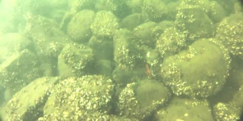
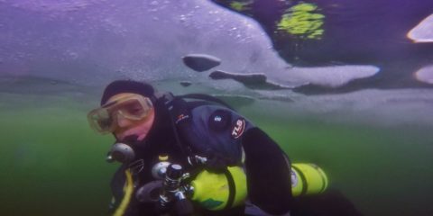
N 46° 10.764 W 93° 31.833′ Hennepin Island has 1300 Zebra Mussels per square foot and it has the most Zebra Mussels per square foot per the Minnesota DNR. This is why the visibility is better here than anywhere else on the lake. In the winter the visibility here is about 50′.
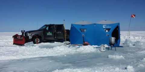
N 46° 12.421′ W 93° 31.902′ Every year there is a pressure ridge in Mille Lacs lake near Fishermans Wharf. The bottom here is football sized rocks and not much to look at, but the pressure ridge is impressive. Visibility here is about 30′ in the winter.

 for more information about the location.