Using the map, click on any  for more information about the location.
Or expand List View by clicking on the "Toggle List View" pop-out tag on the right-hand side.
N 46° 48.435′ W 90° 49.012′ This is a shore dive just off Bodins Fish Market and the public beach at Halvor Reiten Park in Bayfield Wisconsin. There is a lot of slab wood and a few shipwreck timbers in the water just off this beach. There is supposed to be a submerged Model A just of the Bodins Fish Market Dock as well but I did not find it.
N 46° 47.252′ W 92° 5.404′ This is a submerged 900′ long wood dock that trains used to run on to load and unload ships. Toward the end of its useful life, the railroad would take train cars full of junk train parts and roll them into the water from the dock. Not much is left in the way of train parts but a few pieces remain.
N 47° 0.710′ W 91° 40.661′ There are two breakwalls in Two Harbors. This one is the inside of the Southern one. It consists of wood, rock, steel, and concrete and was built inadvertently on top of part of a shipwreck called the Ely. This is a good place to dive if you get blown out of the main lake.
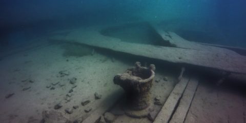
Shipwreck Dive N 47° 0.700' W 91° 40.677'
N 47° 0.700′ W 91° 40.677′ The Ely is a 200′ wood three masted schooner-barge that sank in 1896 in Two Harbors, MN. The tugboat Edna G that is still moored in Two Harbors rescued the 10 crew members from the Ely. The wreck is in 30′ of water and about 30′ of the stern is buried under the breakwall. Visibility here ranges from 2′ to 10′ because of the traffic in the harbor.
N 47° 8.444′ W 91° 27.298′ Gooseberry Falls caverns is a wall dive with several small sea-caves There is a 15′ high cliff that you can use for the giant stride entry and the wall drops about 30 deep before ‘flattening out’ to a 45 degree rocky slope. Exiting the area just North on a rocky beach can be interesting in rough water.
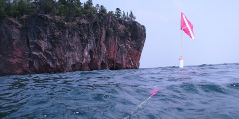
N 47° 12.354′ W 91° 21.458′ The Madeira is a 436′ steel 3 masted schooner-barge that sank in 1905 off Gold Rock Point just north of Split Rock Lighthouse. The bow is between 40 and 50′ deep. The stern is at 65′, & the pilot house was at 75′ but now what’s left of it is at 100′. There is a large debris field just north of the Stern section.
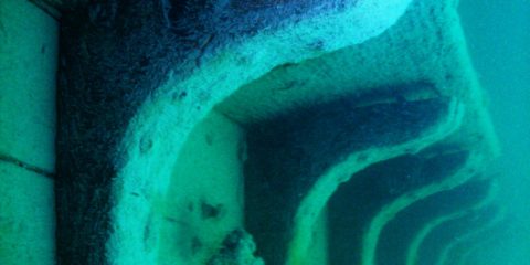
N 47° 16.295′ W 91° 16.232′ The Hesper was a 250′ wooden-hulled, single-screw, triple-masted, cargo ship that sank in Silver Bay, MN in 1905. The ships hull is split open and the sides are laying in a “V” shape. The bow is in 30′ of water and the rudder is at 48′. Visibility here is seldom over 30 because of the proximity of the harbor traffic.
N 47° 20.851′ W 91° 11.028′ This natural cave is at a location where Minnesota Mining & Manufacturing (3M) had a dock in Ilgen, MN (town is no longer there). The cave entry is right next to the rocky beach and after a 75′ swim-thru, the exit is on the lake side of the cliff. The cave itself is open to the air all the way through. There are remains of the 3M dock here to explore as well.
N 47° 44.809′ W 90° 20.084′ This is a shallow shore dive in Grand Marais Harbor. There wasn’t much to see except logs, rocks, Things lost of Moored sailboats, and the occasional shipwreck timber.
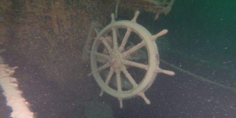
Shipwreck Dive N 48° 5.118' W 88° 46.000'
N 48° 5.118′ W 88° 46.000′ The Kamloops is a 250′ steel canaler that sank in 1927 near Isle Royale. It’s resting on the bottom at 270′ deep, but the top of the stern is at 180′ deep The top of the bow is at 240′ deep. This is a deep wreck well beyond recreational limits, and it is a wreck to be respected.
N 47° 54.725′ W 89° 9.511′ There are many places to dock for the night around Isle Royale. Windigo at one end and Rock Harbor at the other… both offer fuel and showers. There are several other smaller docks around the island in sheltered bays. Most of these areas have 8′ by 16′ shelters that anyone can stay in free for up to 3 days at a time on a first come-first serve basis.
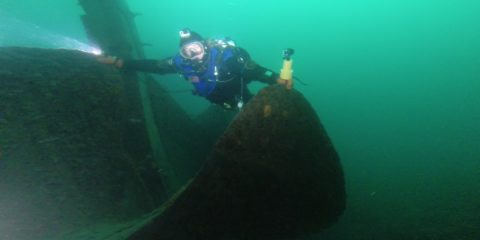
Shipwreck Dive N 47° 51.450' W 89° 19.796'
N 47° 51.450′ W 89° 19.796′ The Henry Chisholm was a wooden bulk freighter that sank in 1898 near Rock of Ages Lighthouse at Isle Royale. The 30′ tall engine sits in 115′ deep water and the 12′ diameter prop is at 155′ deep. The visibility here is between 30′ to 40′ and the water is usually around 40 degrees.
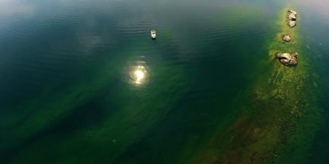
Shipwreck Dive N 47° 51.462' W 89° 19.385'
N 47° 51.462′ W 89° 19.385′ The George M. Cox shipwreck (also called ‘Cox on the Rocks’) is a 233′ steel passenger ship that sank in 1933 near Isle Royale. The bow is in 10′ of water and the stern is 100′ deep. The visibility here is about 40′ mostly and the water temps are generally in the 40’s.
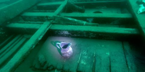
Shipwreck Dive N 48° 11.334' W 88° 25.957'
N 48° 11.334′ W 88° 25.957′ The Monarch Shipwreck is a 259′ wood packet ship that sank in 1906 near Isle Royale. It is broken up between 10′ deep to 80′ deep. There is nothing left to penetrate on this wood wreck as the hull is layed open and artifacts are scattered across the site. Visibility is 25′ to 40′ and the water temp is around 45 degrees.
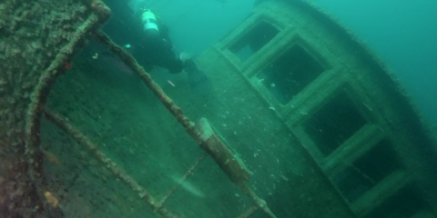
Shipwreck Dive N 48° 11.559' W 88° 30.815'
N 48° 11.559′ W 88° 30.815′ The Chester A. Congdon Bow Shipwreck is the bow section of a 526′ long 56′ wide bulk freighter that sank in 1918 near Isle Royale. The site is from 60′ to 120′ deep and has 4 levels to explore. The bow sits at a 45 degree angle and some call it ‘the fun house’ because of this. Visibility here is usually 30′ with bottom temps about 40 degrees.
Shipwreck Dive N 48° 12.003' W 88° 29.525'
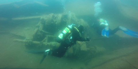
N 48° 12.003′ W 88° 29.525′ The Emperor was 525 feet long, 56 feet in beam. It was hauling 10,000 tons of iron ore when it sank in 1947 just North of Isle Royale. 12 sailors died in this wreck. The sand at the Bow is at 60′. The ‘swim through’ at the turning point for this bow dive is at 93′ deep. At this ‘swim through’ you cross under the 56′ wide hull of the ship. The water is usually about 45 degrees. The visibility is about 40′.
Shipwreck Dive N 48° 12.018' W 88° 29.606'
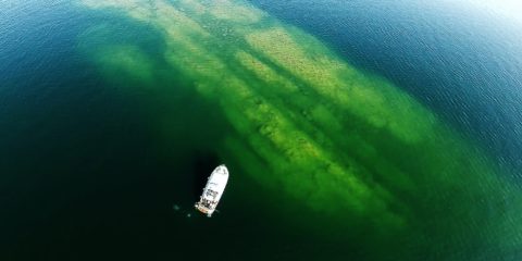
N 48° 12.018′ W 88° 29.606′ The Emperor was 525 feet long, 56 feet in beam. It was hauling 10,000 tons of iron ore when it sank in 1947 just North of Isle Royale. 12 sailors died in this wreck. The sand at the stern is at 180′. The Engine room is at 150′, and the fantail is at 135′ deep. This is one of the best wrecks in the Great Lakes in my opinion. The water is usually about 45 degrees. The visibility is about 40′.
Shipwreck Dive N 47° 53.631' W 89° 13.341'
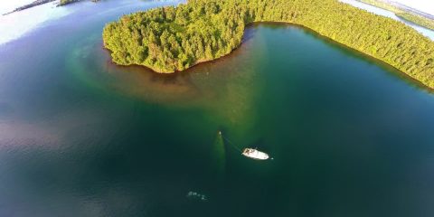
N 47° 53.631′ W 89° 13.341′ The America wreck is 180′ long and sank in 1928. The bow is 2′ below the surface and the stern is 80′ below the surface. This is a shallow wreck in fairly cold water. Average water temperatures here in the summer are between 40 and 50 degrees. Visibility varies, but 30′ to 50′ is common.
Freshwater, Lake Superior
Freshwater, Lake Superior
Freshwater, Lake Superior
Freshwater, Lake Superior, Wreck
Freshwater, Lake Superior, Ledge
Freshwater, Lake Superior, Wreck
Freshwater, Lake Superior, Wreck
Freshwater, Lake Superior
Freshwater, Lake Superior
Freshwater, Lake Superior, Wreck
Freshwater, Lake Superior
Freshwater, Lake Superior, Wreck
Freshwater, Lake Superior, Wreck
Freshwater, Lake Superior, Wreck
Freshwater, Lake Superior, Wreck
Freshwater, Lake Superior, Wreck
Freshwater, Lake Superior, Wreck
Freshwater, Lake Superior, Wreck
