Navigation Menu
X

Welcome!

There are three ways to Look Underwater:

Using the map, click on any for more information about the location.

Or expand List View by clicking on the "Toggle List View" pop-out tag on the right-hand side.

Map markers may also be filtered using the menus below.

Happy Exploring!

OK, Got it!

North Shark Arena at New Providence Island, Bahamas
August 62018

N 24° 58.755′ W 77° 32.094′ Stuart Coves North Shark Arena is about 350′ South of the Ray of Hope and Bahama Mama wrecks. They feed the Nurse Sharks off to the side just prior to feeding about 14 Caribbean reef sharks becaude the nurse sharks are sloppy eaters and the extra chum in the water from this confuses the reef sharks. IT was a lot of fun to be this close to them.

More Information»
Ray of Hope Wreck at New Providence Island, Bahamas

Ray of Hope Wreck at New Providence Island, Bahamas

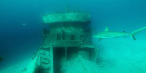
Shipwreck Dive N 24° 58.826' W 77° 32.092'

August 62018

N 24° 58.826′ W 77° 32.092′ The Ray of Hope is a 200′ ship sitting at 50′ deep on the edge of a wall called the Tongue of the Ocean that drops down to 6,000′ The Ray of Hope sits 40′ away from a small wreck called Bahama Mama. Because the North shark Arena is about 350′ to the South, There are plenty of friendly Caribbean Reef sharks around these two wrecks. Visibility here is about 150′.

More Information»
Sea Viking Wreck at New Providence Island, Bahamas

Sea Viking Wreck at New Providence Island, Bahamas

Shipwreck Dive N 24° 58.357' W 77° 31.969'

August 42018

N 24° 58.357′ W 77° 31.969′ The Sea Viking is a 60′ boat sitting at 75′ deep. it is sitting next to what is called Mikes Reef. Mikes Reef is a nursery for juvenile reef sharks that are practicing to be tough-guys.

More Information»
Lost Blue Hole at New Providence Island, Bahamas
August 42018

N 25° 1.604′ W 77° 8.530′ The Lost Blue hole is 7 miles East of New Providence Island and 5 miles South of Rose Island. It is 40′ down to the sand at the top of the 85′ wide hole. The bottom of the hole is 200′ deep. He had 6 Black Tip sharks, 1 Bull shark and a couple nurse sharks with us. The visibility is over 100′.

More Information»
Three Mail Boat Wrecks at Paradise Island, Bahamas

Three Mail Boat Wrecks at Paradise Island, Bahamas

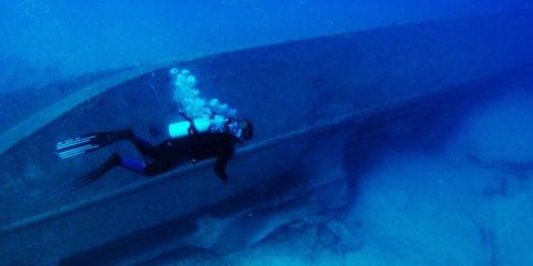
Shipwreck Dive N 25° 5.774' W 77° 19.816'

August 42018

N 25° 5.774′ W 77° 19.816’The Mail Boat wrecks are also called The Shipyard. They are a 90′ long oil tanker called the Bahama Shell, a 95-foot passenger ship named the Helena C., and a 150-foot supply vessel called the Ana Lise. These 3 are located right next to eachother in 90′ deep water. The visibility is about 100′.

More Information»
Car Hauler Wreck at Paradise Island, Bahamas

Car Hauler Wreck at Paradise Island, Bahamas

Shipwreck Dive N 25° 6.104' W 77° 18.579'

August 42018

N 25° 6.104′ W 77° 18.579′ The Car Hauler wreck is sitting upright at 85′ deep. The visibility here is about 60′.

More Information»
Miranda Wreck at Paradise Island, Bahamas

Miranda Wreck at Paradise Island, Bahamas

Shipwreck Dive N 25° 5.998' W 77° 18.431'

August 42018

N 25° 5.998′ W 77° 18.431′ The Miranda is a 90′ wreck that is split in two and sitting in 55′ deep water North of Paradise Island. Visibility here is about 100′.

More Information»
Mahoney Wreck at Paradise Island, Bahamas

Mahoney Wreck at Paradise Island, Bahamas

Shipwreck Dive N 25° 5.859' W 77° 18.645'

August 42018

N 25° 5.859′ W 77° 18.645′ The Mahoney was a 212′ long steel hulled steamer that sank in 1929 off New Providence Island (North of Paridise Island actually). It was blown apart with dynamite to make it less of an obstruction. It sits at 30′ deep with 50′ of visibility.

More Information»
Fish Hotel at Salt Cay, Bahamas

Fish Hotel at Salt Cay, Bahamas

N 25° 6.556' W 77° 16.365'

August 32018

N 25° 6.556′ W 77° 16.365′ Fish Hotel is a rocky reef on the North side of Salt Cay. The easterly current is strong here but the ledges hod a lot of fish and a few lobster. The depth is about 40′ and the visibility is about 50′.

More Information»
Periwinkle Reef at Rose Island, Bahamas

Periwinkle Reef at Rose Island, Bahamas

N 25° 4.391' W 77° 11.903'

August 32018

N 25° 4.391′ W 77° 11.903′ Periwinkle reef is a shallow drift dive over a soft coral reef just South of Rose Island. It is about 30′ deep with visibility about 70′

More Information»
Landing Craft Wreck at Atholl Cay, Bahamas

Landing Craft Wreck at Atholl Cay, Bahamas

Shipwreck Dive N 25° 4.185' W 77° 15.318'

August 32018

N 25° 4.185′ W 77° 15.318′ This landing Craft sank North East of Rose Island after WW2 when it took on water delivering materials. After that it was used in a James Bond movie Thunderball. It sits in 20′ of water with about 50′ visibility.

More Information»
Lighthouse Wreck at Nassau, Bahamas

Lighthouse Wreck at Nassau, Bahamas

Shipwreck Dive N 25° 5.245' W 77° 21.123'

August 32018

N 25° 5.245′ W 77° 21.123′ The lighthouse wreck is a steel ship that sank just NW from the Nassau Harbor lighthouse. Visibility here is about 50′

More Information»
All Listing Types All Locations Any Rating

Listing Results

  • North Shark Arena at New Providence Island, Bahamas

    Bahamas, Saltwater

    Read more
  • Ray of Hope Wreck at New Providence Island, Bahamas

    Bahamas, Saltwater, Wreck

    Read more
  • Sea Viking Wreck at New Providence Island, Bahamas

    Bahamas, Saltwater, Wreck

    Read more
  • Lost Blue Hole at New Providence Island, Bahamas

    Bahamas, Coral Reef, Saltwater, Sink Hole

    Read more
  • Three Mail Boat Wrecks at Paradise Island, Bahamas

    Bahamas, Saltwater, Wreck

    Read more
  • Car Hauler Wreck at Paradise Island, Bahamas

    Bahamas, Saltwater, Wreck

    Read more
  • Miranda Wreck at Paradise Island, Bahamas

    Bahamas, Saltwater, Wreck

    Read more
  • Mahoney Wreck at Paradise Island, Bahamas

    Bahamas, Saltwater, Wreck

    Read more
  • Fish Hotel at Salt Cay, Bahamas

    Bahamas, Coral Reef, Saltwater

    Read more
  • Periwinkle Reef at Rose Island, Bahamas

    Bahamas, Coral Reef, Saltwater

    Read more
  • Landing Craft Wreck at Atholl Cay, Bahamas

    Bahamas, Saltwater, Wreck

    Read more
  • Lighthouse Wreck at Nassau, Bahamas

    Bahamas, Saltwater, Wreck

    Read more